
Car Nicobar
Car Nicobar (Pū in
Annual rainfall is 2800 millimetres.History
The sea farers of the region referred to the island as the "northern land of the nake" i.e. Car Nakkavar which is perhaps the direct predecessor of the current name Car Nicobar.
2004 tsunami devastation
The island was severely affected by the
Geography
Car Nicobar falls in between Little Andaman and Nancowry. The area south to the Ten-degree channel comes under Car Nicobar headquarters. Car Nicobar is remarkably flat except for some cliffs in the north and small hilly areas in the interior. It is bordered by a silvery beach and areas of flat ground consisting of coraline diluvium.[4] It is a flat fertile island covered with clusters of coconut palms and enchanting beaches with a roaring sea all around.
Compared to the
The soil analysis revealed a high content of sand & clay hindering the growth of agricultural crops. The area of Car Nicobar is suitable for the plantation crops, and
Climate
The climate of Car Nicobar Island is a tropical monsoon climate (Koppen: Am), as it is just 9 degree from the equator, with an annual rainfall of 400 mm. The data of past ten years shows that the mean relative humidity in the Island is 79%, the mean maximum temperature is of 30.20 C, and mean minimum temperature is 23.00 C.
| Climate data for Car Nicobar (1981–2010, extremes 1952–2012) | |||||||||||||
|---|---|---|---|---|---|---|---|---|---|---|---|---|---|
| Month | Jan | Feb | Mar | Apr | May | Jun | Jul | Aug | Sep | Oct | Nov | Dec | Year |
| Record high °C (°F) | 34.4 (93.9) |
35.0 (95.0) |
36.0 (96.8) |
37.0 (98.6) |
38.0 (100.4) |
33.8 (92.8) |
37.0 (98.6) |
33.2 (91.8) |
33.4 (92.1) |
34.8 (94.6) |
37.0 (98.6) |
35.6 (96.1) |
38.0 (100.4) |
| Mean daily maximum °C (°F) | 31.2 (88.2) |
31.7 (89.1) |
32.4 (90.3) |
32.9 (91.2) |
31.7 (89.1) |
31.1 (88.0) |
30.9 (87.6) |
30.8 (87.4) |
30.5 (86.9) |
30.6 (87.1) |
30.8 (87.4) |
30.8 (87.4) |
31.3 (88.3) |
| Mean daily minimum °C (°F) | 24.1 (75.4) |
23.3 (73.9) |
22.9 (73.2) |
23.4 (74.1) |
23.9 (75.0) |
24.6 (76.3) |
24.4 (75.9) |
24.3 (75.7) |
23.5 (74.3) |
23.4 (74.1) |
24.0 (75.2) |
23.8 (74.8) |
23.8 (74.8) |
| Record low °C (°F) | 11.0 (51.8) |
12.0 (53.6) |
10.9 (51.6) |
15.4 (59.7) |
16.4 (61.5) |
15.6 (60.1) |
15.6 (60.1) |
16.0 (60.8) |
15.6 (60.1) |
15.0 (59.0) |
15.3 (59.5) |
11.9 (53.4) |
11.0 (51.8) |
| Average rainfall mm (inches) | 39.5 (1.56) |
35.9 (1.41) |
59.2 (2.33) |
116.1 (4.57) |
387.9 (15.27) |
265.4 (10.45) |
279.6 (11.01) |
279.5 (11.00) |
373.0 (14.69) |
293.4 (11.55) |
306.1 (12.05) |
164.6 (6.48) |
2,600.2 (102.37) |
| Average rainy days | 2.5 | 1.9 | 2.9 | 5.2 | 15.5 | 12.9 | 12.8 | 12.5 | 14.2 | 14.3 | 12.9 | 6.6 | 114.2 |
| Average relative humidity (%) (at 17:30 IST )
|
79 | 76 | 76 | 77 | 84 | 85 | 85 | 85 | 87 | 88 | 86 | 80 | 82 |
| Source: India Meteorological Department[5][6] | |||||||||||||
Administration
Car Nicobar, along with neighboring
Although the area of Car Nicobar is less than 7% of the area of the Nicobar group, in the census of 2011 its population of[8] 17841 was 48% of the total population of Nicobar.
Flora and fauna
The Car Nicobar islands do not have any evergreen forests, which dominate the central and southern islands of the Nicobars.[9] Most of the island is covered with coconut plantation and natural flora is present only in the interior areas.
Important Bird Area
The island has been designated an
Transport
Car Nicobar the district headquarters is 260 km (162 mi) from Port Blair. Ship service is available between Port Blair and Nicobar district. Normally ship is available twice in a week. One can obtain the ship ticket from the office of the Director, Shipping services (03192-245555) at Port Blair.[11]
Andaman and Nicobar Islands Administration in cooperation with
Demographics

There are 21 villages, the largest of which is named U-rèk-ka (called "Malacca-Perka" for tourists), with a population of 4,200.
The villages are:
- Ha-nyôch (Mus)
- Tö-kuö-nö Sē-ti (Small Lapathy)
- Tö-ki-röng Sē-ti (Big Lapathy)
- Höng-chu (Tapoiming)
- Pum-pai (Chukchucha)
- Sa-rā-ki (Kinyuka)
- Tim-lö (Tamalu)
- Kè-è-rô (Perka, West Malacca)
- U-rèk-ka (Malacca)
- IAF Camp
- Sa-pë-ha (Kakana)
- Ratana
- Öt-ra-höön (Kimius)
- Aukchong
- Foul Point
- Ha-ran (Arong)
- Arong Beach
- Öt-ka-sip (Sawai)
- Rit-töp (Titop)
- Passa
- Töt-chak (Kinmai)
The names in brackets are often used for tourists and other outsiders, as the local names in Nicobarese are difficult for outsiders to pronounce.
Each village has a tuhet meaning "elderly heads", the number of which varies. From each of these elders three are elected as 1st, 2nd, and 3rd captain to look after the day-to-day affairs of the village.
According to the 2011 census of India, Car Nicobar Island has 4250 households. The effective literacy rate (i.e. the literacy rate of population excluding children aged 6 and below) is 100%.[12]
| Total | Male | Female | |
|---|---|---|---|
| Population | 17841 | 9735 | 8106 |
| Children aged below 6 years | 1929 | 982 | 947 |
Scheduled caste |
0 | 0 | 0 |
Scheduled tribe |
15027 | 7659 | 7368 |
| Literates | 12627 | 7436 | 5191 |
| Workers (all) | 8844 | 5964 | 2880 |
| Main workers (total) | 3664 | 2916 | 748 |
Administration
The island belongs to the
Image gallery
-
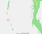 Location of Car Nicobar island
 -
 Map
Map


See also
- Car Nicobar Air Force Base
References
- ^ "Islandwise Area and Population - 2011 Census" (PDF). Government of Andaman. Archived from the original (PDF) on 2017-08-28. Retrieved 2016-05-02.
- ^ Registration Plate Numbers added to ISO Code
- ^ "Village Code Directory: Andaman & Nicobar Islands" (PDF). Census of India. Retrieved January 16, 2011.
- ^ "Nicobar Geographical Features". 2013-05-26. Archived from the original on 2016-02-07. Retrieved 2013-05-26.
- ^ "Station: Car-Nicobar Climatological Table 1981–2010" (PDF). Climatological Normals 1981–2010. India Meteorological Department. January 2015. pp. 171–172. Archived from the original (PDF) on 5 February 2020. Retrieved 8 February 2020.
- ^ "Extremes of Temperature & Rainfall for Indian Stations (Up to 2012)" (PDF). India Meteorological Department. December 2016. p. M1. Archived from the original (PDF) on 5 February 2020. Retrieved 8 February 2020.
- ^ "A&N Islands - Pincodes". 2013-05-26. Archived from the original on 2014-03-23. Retrieved 2013-05-26.
- ^ "Census of India".
- ^ "A&N Islands - Flora & Fauna". 2013-05-26. Archived from the original on 2016-03-17. Retrieved 2013-05-26.
- ^ "Car Nicobar". BirdLife Data Zone. BirdLife International. 2020. Retrieved 13 December 2020.
- ^ "Nicobar Islands - How to reach". 2013-05-26. Archived from the original on 2012-02-13. Retrieved 2013-05-26.
- ^ 2011 Census of India. Directorate of Census Operations, Andaman & Nicobar Islands. Archived from the original(PDF) on 2015-08-01. Retrieved 2015-07-21.
- ^ "Tehsils" (PDF). Archived from the original (PDF) on 2017-08-28. Retrieved 2016-05-02.
 Andaman and Nicobar Islands travel guide from Wikivoyage
| International | |
|---|---|
| National | |