
Gangotri Glacier
| Gangotri | |
|---|---|
Valley glacier | |
| Location | India |
| Coordinates | 30°50′N 79°10′E / 30.833°N 79.167°E |
 | |
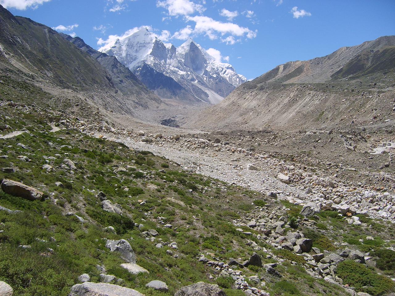
Gangotri glacier (
The
The Gangotri glacier is a traditional
_may_28_2007.JPG)
Geology
It is a valley-type glacier, situated in the
The total ice cover is approximately 200 km2 and has about 20 km3 of ice in volume.[3]
Tributaries
This glacier has three main tributaries, namely Raktvarn (15.90 km), Chaturangi (including Kalindi bamak) (22.45 km) and Kirti (11.05 km) and more than 18 smaller tributary glaciers The Raktvarn system contains 7 tributary glaciers; among them Thelu, Swetvarn, Nilambar and Pilapani are important. Similarly the Seeta, Suralaya and Vasuki are the major tributaries which make up the Chaturangi system, while the Kirti system is made up of only three tributary glaciers. Besides these three major tributary systems, some other tributary glaciers of this area drain directly into the Gangotri glacier; among them Swachand, Miandi, Sumeru and Ghanohim are important. Four other glaciers, Maitri, Meru, Bhrigupanth and Manda drain into the river Bhagirathi. The total glacierized area of the catchment is 258.56 km2, out of which the Gangotri system comprises 109.03 km2, followed by Chaturangi (72.91 km2), Raktvarn (45.34 km2) and Kirti (31.28 km2). The remaining four glaciers contain 29.41 km2 of glacierized area; among them maximum contribution is Bhirgupanth glacier (14.95 km2).
Retreat

NASA, in conjunction with scientists from United States Geological Survey (USGS) and the National Snow and Ice Data Center (NSIDC), is developing a global inventory of all the world's glaciers to help researchers track each glacier's history. According to them, the Gangotri glacier, currently 30.2 km long and between 0.5 and 2.5 km wide, is one of the largest in the Himalayas. This glacier has been constantly receding since measurements began in 1780. Data for 61 years (1936–96) showed the total recession of Gangotri glacier as 1147 m, with an average rate of 19 m per year.[4] However over the last 25 years into the 21st century it has retreated more than 850 meters (34 meters per year),[5] and 76 meters between 1996 and 1999 (25 meters per year)[6][7]
See also
- List of glaciers
- Gomukh
- Bara Shigri
Notes
- ^ Gyan Marwah. "Ganges - A River of No Return?". the-south-asian.com. Archived from the original on 16 September 2013. Retrieved 24 June 2007.
- ^ Metcalfe, R. P., Geol. Soc. London, 1993, 74, 495–509.
- ^ Vohra, C. P., in The Himalayas: Aspects of Change (eds Lall, J. S. and Moddie, A. D.), Oxford University Press, New Delhi, 1981, pp 138–151.
- ^ Ajay K. Naithani, H. C. Nainwal, K. K. Sati and C. Prasad: Geomorphological evidences of retreat of the Gangotri glacier and its characteristics. Current Science, 2001, Vol. 80, No. 1, 87-94. http://www.ias.ac.in/currsci/jan102001/87.pdf Archived 17 October 2020 at the Wayback Machine
- ^ Sharma, M. C. and Owen, L. A., J. Quat. Sci. Rev., 1996, 15, 335–365.
- ^ article at Earth Observatory driven by NASA Archived 31 December 2009 at the Wayback Machine, found below a sat image illustration dated 2001
- .
References
- Bali, R., Awasthi, D.D. and Tiwari, N.K.2003 Neotectonic control on the geomorphic evolution of the Gangotri Glacier Valley, Garhwal Himalaya, Gondwana Research, 2003, Vol, 6 (4) pp. 829–838.
- Awasthi, D.D., Bali, R. and Tiwari, N.K. 2004. Relative dating by lichenometric and Schmidt Hammer techniques in the Gangotri glacier valley, Uttarkashi District, Uttaranchal. Spl. Pub. Pal. Soc. Ind no. 2 pp. 201– 206.
- Awasthi, D.D., Bali, R. and Tiwari, N.K. 2004. Growth rate of Lichen Dimelaena Orina in the Gangotri Glacier valley, Uttarkashi District, Uttaranchal: Some Significant Observations Geol. Sur. Ind. Spl. Pub. No. 80.
- Singh, Dhruv Sen 2004. Late Quaternary Morpho-Sedimentary Processes in the Gangotri Glacier Area, Garhwal Himalaya, India. Geol Surv India Spl. Pub. No.80, 2004: 97-103.
- Singh, Dhruv Sen and Mishra. A. 2002. Gangotri Glacier System, Garhwal Himalaya: An analysis using GIS technique. Aspects of Geology and Environment of the Himalaya. Edited by Pant, C. C. and Sharma, A. Gyanodaya Prakashan, Nainital, India, pp 349–358.
- Singh, Dhruv Sen and Mishra. A. 2002. Role of Tributary glaciers on landscape modification in the Gangotri Glacier area, Garhwal Himalaya, India. Current Science, 82 (5), 101-105. http://www.ias.ac.in/currsci/mar102002/567.pdf
- Singh, Dhruv Sen and Mishra, A. 2001. Gangotri Glacier characteristics, retreat and processes of sedimentation in the Bhagirathi valley. Geological Survey of India Spl. Pub.No.65 (III), 17-20.
- Lal, P.; Vaka, D. S.; Rao, Y. S. (15 November 2018). "Mapping Surface Flow Velocities of Siachen and Gangotri Glaciers Using Terrasar-X and Sentinel-1A Data by Intensity Tracking". ISPRS Annals of the Photogrammetry, Remote Sensing and Spatial Information Sciences. IV-5: 325–329. doi:10.5194/isprs-annals-IV-5-325-2018.
External links
- Retreat of the Gangotri Glacier, an article from NASA's Earth Observatory
- Gaumukh and Gangotri Art Photos
- Save Gangotri, highlights localized ecological damage and conservation efforts in the region
- Geomorphological evidences of retreat of the Gangotri glacier and its characteristics, A Study by Department of Geology, HNB Garhwal University
- 283 photos 1280x960 of trekking from Gangotri to Gaumukh. You can see the retreat of the Gangotri glacier on picture gomukh141.jpg
| International | |
|---|---|
| National | |