
Algeria
People's Democratic Republic of Algeria
| |
|---|---|
| Motto: بِالشَّعْبِ و لِلشَّعْبِ "Biš-šaʿb wa liš-šaʿb" "By the people and for the people"[1][2] | |
| Anthem: قَسَمًا Qasaman "We Pledge" | |
.svg) Location of Algeria (dark green) | |
| Capital and largest city | Algiers 36°42′N 3°13′E / 36.700°N 3.217°E |
| Official languages | |
| Local vernaculars | |
| Foreign languages | |
| Religion (2012)[3] |
|
| Demonym(s) | Algerian |
| Government | Unitary semi-presidential republic |
| Abdelmadjid Tebboune | |
| Nadir Larbaoui | |
| Salah Goudjil | |
| Ibrahim Boughali | |
| Legislature | Parliament |
| Council of the Nation | |
| People's National Assembly | |
| Formation | |
• Numidia | 202 BC |
| 1516 | |
| 5 July 1830 | |
| 5 July 1962 | |
| Area | |
• Total | 2,381,741 km2 (919,595 sq mi) (10th) |
• Water (%) | 1.1 |
| Population | |
• 2022 estimate | 45,400,000[4] (32nd) |
• Density | 19/km2 (49.2/sq mi) (171th) |
| GDP (PPP) | 2023 estimate |
• Total | |
• Per capita | |
| GDP (nominal) | 2023 estimate |
• Total | |
• Per capita | |
| Gini (2011) | 27.6[6][7] low |
| HDI (2022) | high (93rd) |
| Currency | Algerian dinar (DZD) |
| Time zone | UTC+1 (CET) |
| Date format | dd/mm/yyyy |
| Driving side | right |
| Calling code | +213 |
| ISO 3166 code | DZ |
| Internet TLD | |


Algeria,[c] officially the People's Democratic Republic of Algeria,[d] is a country in the Maghreb region of North Africa. It is bordered to the northeast by Tunisia; to the east by Libya; to the southeast by Niger; to the southwest by Mali, Mauritania, and Western Sahara; to the west by Morocco; and to the north by the Mediterranean Sea. Algeria has a semi-arid climate, with the Sahara desert dominating most of the territory except for its fertile and mountainous north, where most of the population is concentrated. Spanning 2,381,741 square kilometres (919,595 sq mi), it is the world's tenth largest nation by area, and the largest nation in Africa.[9] With a population of 44 million, Algeria is the tenth-most populous country in Africa, and the 32nd-most populous country in the world. The capital and largest city is Algiers, located in the far north on the Mediterranean coast.
Inhabited since
Algeria's official languages are Arabic and Tamazight; French is used in media, education, and certain administrative matters. The vast majority of the population speak the Algerian dialect of Arabic. Most Algerians are Arabs, with Berbers forming a sizeable minority. Sunni Islam is the official religion and practised by 99 percent of the population.[12]
Algeria is a
Name

Other forms of the name are:
Etymology
Algeria's name derives from the city of Algiers, which in turn derives from the Arabic al-Jazāʾir (الجزائر, "the islands"), referring to four small islands off its coast,[15] a truncated form of the older Jazāʾir Banī Mazghanna (جزائر بني مزغنة, "islands of Bani Mazghanna").[16][17][page needed][18][page needed] The name was given by Buluggin ibn Ziri after he established the city on the ruins of the Phoenician city of Icosium in 950.[19] It was employed by medieval geographers such as Muhammad al-Idrisi and Yaqut al-Hamawi.
Algeria took its name from the Regency of Algeria[20][21][22] or Regency of Algiers,[23] when Ottoman rule was established in the central Maghreb in early 16th century. This period saw the installation of a political and administrative organization which participated in the establishment of the Algerian: وطن الجزائر (watan el djazâïr, country of Algiers) and the definition of its borders with its neighboring entities on the east and west.[24] The Ottoman Turks who setteled in Algeria referred both to themselves,[25][20][26][27] and the peoples as "Algerians".[20] Acting as a central military and political authority in the regency, the Ottoman Turks shaped the modern political identity of Algeria as a state pocessing all the attributes of sovereign independence, despite still being nominally subject to the Ottoman sultan.[28][29] Algerian nationalist, historian and statesman Ahmed Tewfik El Madani regarded the regency as the "first Algerian state" and the "Algerian Ottoman republic".[26][30][31]
History
Prehistory and ancient history

Around ~1.8-million-year-old stone artifacts from Ain Hanech (Algeria) were considered to represent the oldest archaeological materials in North Africa.[32] Stone artifacts and cut-marked bones that were excavated from two nearby deposits at Ain Boucherit are estimated to be ~1.9 million years old, and even older stone artifacts to be as old as ~2.4 million years.[32] Hence, the Ain Boucherit evidence shows that ancestral hominins inhabited the Mediterranean fringe in northern Africa much earlier than previously thought. The evidence strongly argues for early dispersal of stone tool manufacture and use from East Africa, or a possible multiple-origin scenario of stone technology in both East and North Africa.
Neanderthal tool makers produced hand axes in the Levalloisian and Mousterian styles (43,000 BC) similar to those in the Levant.[33][34] Algeria was the site of the highest state of development of Middle Paleolithic Flake tool techniques.[35] Tools of this era, starting about 30,000 BC, are called Aterian (after the archaeological site of Bir el Ater, south of Tebessa).
The earliest blade industries in North Africa are called
.jpg)
From their principal center of power at
As Carthaginian power grew, its impact on the indigenous population increased dramatically. Berber civilisation was already at a stage in which agriculture, manufacturing, trade, and political organisation supported several states. Trade links between Carthage and the Berbers in the interior grew, but territorial expansion also resulted in the enslavement or military recruitment of some Berbers and in the extraction of tribute from others.

By the early 4th century BC, Berbers formed the single largest element of the Carthaginian army. In the Revolt of the Mercenaries, Berber soldiers rebelled from 241 to 238 BC after being unpaid following the defeat of Carthage in the First Punic War.[38] They succeeded in obtaining control of much of Carthage's North African territory, and they minted coins bearing the name Libyan, used in Greek to describe natives of North Africa. The Carthaginian state declined because of successive defeats by the Romans in the Punic Wars.[39]
In 146 BC the city of
After Masinissa's death in 148 BC, the Berber kingdoms were divided and reunited several times. Masinissa's line survived until 24 AD, when the remaining Berber territory was annexed to the Roman Empire.
.jpg)
For several centuries Algeria was ruled by the Romans, who founded many colonies in the region, Algeria is the second country in the world after Italy, home to the largest number of Roman sites and remains among the most alive and well preserved. Rome, after getting rid of its powerful rival Carthage in the year 146 BC, decided a century later to include Numidia to become the new master of North Africa. They built more than 500 cities.
The collapse of the Western Roman Empire led to the establishment of a native Kingdom based in Altava (modern-day Algeria) known as the Mauro-Roman Kingdom. It was succeeded by another Kingdom based in Altava, the Kingdom of Altava. During the reign of Kusaila its territory extended from the region of modern-day Fez in the west to the western Aurès and later Kairaouan and the interior of Ifriqiya in the east.[49][50][51][52][53][54]
Middle Ages
After negligible resistance from the locals, Muslim Arabs of the Umayyad Caliphate conquered Algeria in the early 8th century.
Large numbers of the indigenous Berber people converted to Islam. Christians, Berber and Latin speakers remained in the great majority in Tunisia until the end of the 9th century and Muslims only became a vast majority some time in the 10th.

During the
The
Several
Following the Berber revolt numerous independent states emerged across the Maghreb. In Algeria the Rustamid Kingdom was established. The Rustamid realm stretched from Tafilalt in Morocco to the Nafusa mountains in Libya including south, central and western Tunisia therefore including territory in all of the modern day Maghreb countries, in the south the Rustamid realm expanded to the modern borders of Mali and included territory in Mauritania.[66][67][68]
Once extending their control over all of the Maghreb, part of Spain
As the Fatimid state was at the time too weak to attempt a direct invasion, they found another means of revenge. Between the
Whole tribes set off with women, children, elders, animals and camping equipment. Some stopped on the way, especially in

The invasion kept going, and in 1057 the Arabs spread on the high plains of
The Almohads originating from modern day Morocco, although founded by a man originating from modern day Algeria[81] known as Abd al-Mu'min would soon take control over the Maghreb. During the time of the Almohad Dynasty Abd al-Mu'min's tribe, the Koumïa, were the main supporters of the throne and the most important body of the empire.[82] Defeating the weakening Almoravid Empire and taking control over Morocco in 1147,[83] they pushed into Algeria in 1152, taking control over Tlemcen, Oran, and Algiers,[84] wrestling control from the Hilian Arabs, and by the same year they defeated Hammadids who controlled Eastern Algeria.[84]
Following their decisive defeat in the

The Zayyanids retained their control over Algeria for 3 centuries. Much of the eastern territories of Algeria were under the authority of the
After several conflicts with local
Early modern era

In 1516, the Turkish privateer brothers
The next beylerbey was Hayreddin's son
Plague had repeatedly struck the cities of North Africa. Algiers lost between 30,000 and 50,000 inhabitants to the plague in 1620–21, and had high fatalities in 1654–57, 1665, 1691 and 1740–42.[101]

The
In July 1627 two pirate ships from Algiers under the command of


In 1659, the Janissaries stationned in Algiers, also known commonly as the Odjak of Algiers; and the Reis or the company of corsair captains rebelled, they removed the Ottoman viceroy from power, and placed one of its own in power. The new leader received the title of "Agha" then "Dey" in 1671, and the right to select passed to the divan, a council of some sixty military senior officers. Thus Algiers became a sovereign military republic. It was at first dominated by the odjak; but by the 18th century, it had become the dey's instrument. Although Algiers remained nominally part of the Ottoman Empire,[98] in reality they acted independently from the rest of the Empire,[113][114] and often had wars with other Ottoman subjects and territories such as the Beylik of Tunis.[115]
The
Barbary raids in the Mediterranean continued to attack Spanish merchant shipping, and as a result, the Spanish Empire launched an invasion in 1775, then the Spanish Navy bombarded Algiers in 1783 and 1784.[99] For the attack in 1784, the Spanish fleet was to be joined by ships from such traditional enemies of Algiers as Naples, Portugal and the Knights of Malta. Over 20,000 cannonballs were fired, but all these military campaigns were doomed and Spain had to ask for peace in 1786 and paid 1 million pesos to the Dey.
In 1792, Algiers took back Oran and Mers el Kébir, the two last Spanish strongholds in Algeria.[118] In the same year, they conquered the Moroccan Rif and Oujda, which they then abandoned in 1795.[119]
In the 19th century, Algerian pirates forged affiliations with Caribbean powers, paying a "license tax" in exchange for safe harbor of their vessels.[120]
Attacks by Algerian pirates on American merchantmen resulted in the First and Second Barbary Wars, which ended the attacks on U.S. ships in 1815. A year later, a combined Anglo-Dutch fleet, under the command of Lord Exmouth bombarded Algiers to stop similar attacks on European fishermen. These efforts proved successful, although Algerian piracy would continue until the French conquest in 1830.[121]
French colonization (1830–1962)

Under the pretext of a slight to their consul, the
Alexis de Tocqueville wrote and never completed an unpublished essay outlining his ideas for how to transform Algeria from an occupied tributary state to a colonial regime, wherein he advocated for a mixed system of "total domination and total colonization" whereby French military would wage total war against civilian populations while a colonial administration would provide rule of law and property rights to settlers within French occupied cities.[135]
From 1848 until independence, France administered the whole Mediterranean region of Algeria as an integral part and département of the nation. One of France's longest-held overseas territories, Algeria became a destination for hundreds of thousands of
During the late 19th and early 20th century, the European share was almost a fifth of the population. The French government aimed at making Algeria an assimilated part of France, and this included substantial educational investments especially after 1900. The indigenous cultural and religious resistance heavily opposed this tendency, but in contrast to the other colonized countries' path in central Asia and Caucasus, Algeria kept its individual skills and a relatively human-capital intensive agriculture.[140]
During the
Gradually, dissatisfaction among the Muslim population, which lacked political and economic status under the colonial system, gave rise to demands for greater political autonomy and eventually independence from
The war led to the death of hundreds of thousands of Algerians and hundreds of thousands of injuries. Historians, like Alistair Horne and Raymond Aron, state that the actual number of Algerian Muslim war dead was far greater than the original FLN and official French estimates but was less than the 1 million deaths claimed by the Algerian government after independence. Horne estimated Algerian casualties during the span of eight years to be around 700,000.[145] The war uprooted more than 2 million Algerians.[146]
The war against French rule concluded in 1962, when Algeria gained complete independence following the March 1962
The first three decades of independence (1962–1991)
The number of European
Algeria's first president was the Front de Libération Nationale (
Boumédienne's successor,
The Algerian economy became increasingly dependent on oil, leading to hardship when the price collapsed during the 1980s oil glut.[149] Economic recession caused by the crash in world oil prices resulted in Algerian social unrest during the 1980s; by the end of the decade, Bendjedid introduced a multi-party system. Political parties developed, such as the Islamic Salvation Front (FIS), a broad coalition of Muslim groups.[148]
Civil War (1991–2002) and aftermath
In December 1991 the
Algeria held
Bouteflika was re-elected in the
In November 2008, the
A continuing series of protests throughout the country started on 28 December 2010, inspired by similar protests across the Middle East and North Africa. On 24 February 2011, the government lifted Algeria's 19-year-old state of emergency.[152] The government enacted legislation dealing with political parties, the electoral code, and the representation of women in elected bodies.[153] In April 2011, Bouteflika promised further constitutional and political reform.[148] However, elections are routinely criticised by opposition groups as unfair and international human rights groups say that media censorship and harassment of political opponents continue.
On 2 April 2019, Bouteflika resigned from the presidency after
In December 2019, Abdelmadjid Tebboune became Algeria's president, after winning the first round of the presidential election with a record abstention rate – the highest of all presidential elections since Algeria's democracy in 1989. Tebboune is accused of being close to the military and being loyal to the deposed president. Tebboune rejects these accusations, claiming to be the victim of a witch hunt. He also reminds his detractors that he was expelled from the Government in August 2017 at the instigation of oligarchs languishing in prison.[155]
Geography


Since the 2011 breakup of Sudan, and the creation of South Sudan, Algeria has been the largest country in Africa, and the
Algeria lies mostly between latitudes
The

Climate and hydrology

In this region, midday desert temperatures can be hot year round. After sunset, however, the clear, dry air permits rapid loss of heat, and the nights are cool to chilly. Enormous daily ranges in temperature are recorded.
Rainfall is fairly plentiful along the coastal part of the Tell Atlas, ranging from 400 to 670 mm (15.7 to 26.4 in) annually, the amount of precipitation increasing from west to east.
Farther inland, the rainfall is less plentiful. Algeria also has ergs, or sand dunes, between mountains. Among these, in the summer time when winds are heavy and gusty, temperatures can go up to 43.3 °C (110 °F).
Fauna and flora
The varied vegetation of Algeria includes
A variety of bird species makes the country an attraction for bird watchers. The forests are inhabited by boars and jackals.
In the north, some of the native flora includes
Camels are used extensively; the desert also abounds with venomous and nonvenomous snakes, scorpions, and numerous insects.
Government and politics
_(cropped).jpg)
Elected politicians have relatively little sway over Algeria. Instead, a group of unelected civilian and military "décideurs" ("deciders"), known as "le pouvoir" ("the power"), actually rule the country, even deciding who should be president.
The head of state is the
.jpg)
The Algerian parliament is
Parliamentary elections were last held in
Foreign relations
Algeria is included in the European Union's European Neighbourhood Policy (ENP) which aims at bringing the EU and its neighbours closer. Giving incentives and rewarding best performers, as well as offering funds in a faster and more flexible manner, are the two main principles underlying the European Neighbourhood Instrument (ENI) that came into force in 2014. It has a budget of €15.4 billion and provides the bulk of funding through a number of programmes.
In 2009, the French government agreed to compensate victims of nuclear tests in Algeria. Defence Minister Herve Morin stated that "It's time for our country to be at peace with itself, at peace thanks to a system of compensation and reparations," when presenting the draft law on the payouts. Algerian officials and activists believe that this is a good first step and hope that this move would encourage broader reparation.[174]
Tensions between Algeria and Morocco in relation to the Western Sahara have been an obstacle to tightening the Arab Maghreb Union, nominally established in 1989, but which has carried little practical weight.[175] On 24 August 2021, Algeria announced the break of diplomatic relations with Morocco.[176]
Military

The military of Algeria consists of the
Total military personnel include 147,000 active, 150,000 reserve, and 187,000 paramilitary staff (2008 estimate).[177] Service in the military is compulsory for men aged 19–30, for a total of 12 months.[178] The military expenditure was 4.3% of the gross domestic product (GDP) in 2012.[12] Algeria has the second largest military in North Africa with the largest defence budget in Africa ($10 billion).[179] Most of Algeria's weapons are imported from Russia, with whom they are a close ally.[179][180]
In 2007, the Algerian Air Force signed a deal with Russia to purchase 49
Human rights
Algeria has been categorised by the US government funded
Independent and autonomous trade unions face routine harassment from the government, with many leaders imprisoned and protests suppressed. In 2016, a number of unions, many of which were involved in the 2010–2012 Algerian Protests, have been deregistered by the government.[184][185][186]
Homosexuality is illegal in Algeria.[187] Public homosexual behavior is punishable by up to two years in prison.[188] Despite this, about 26% of Algerians think that homosexuality should be accepted, according to the survey conducted by the BBC News Arabic-Arab Barometer in 2019. Algeria showed largest LGBT acceptance compared to other Arab countries where the survey was conducted.[189]
Human Rights Watch has accused the Algerian authorities of using the COVID-19 pandemic as an excuse to prevent pro-democracy movements and protests in the country, leading to the arrest of youths as part of social distancing.[190]
Administrative divisions
Algeria is divided into 58
The administrative divisions have changed several times since independence. When introducing new provinces, the numbers of old provinces are kept, hence the non-alphabetical order. With their official numbers, currently (since 1983) they are:[12]
| # | Wilaya | Area (km2) | Population | map | # | Wilaya | Area (km2) | Population |
|---|---|---|---|---|---|---|---|---|
| 1 | Adrar | 402,197 | 439,700 | _-_Nmbrs_(geosort)_-_monochrome.svg) |
30 | Ouargla | 211,980 | 552,539 |
| 2 | Chlef | 4,975 | 1,013,718 | 31 | Oran | 2,114 | 1,584,607 | |
| 3 | Laghouat | 25,057 | 477,328 | 32 | El Bayadh | 78,870 | 262,187 | |
| 4 | Oum El Bouaghi | 6,768 | 644,364 | 33 | Illizi | 285,000 | 54,490 | |
| 5 | Batna | 12,192 | 1,128,030 | 34 | Bordj Bou Arréridj | 4,115 | 634,396 | |
| 6 | Béjaïa | 3,268 | 915,835 | 35 | Boumerdes | 1,591 | 795,019 | |
| 7 | Biskra | 20,986 | 730,262 | 36 | El Taref | 3,339 | 411,783 | |
| 8 | Béchar | 161,400 | 274,866 | 37 | Tindouf | 58,193 | 159,000 | |
| 9 | Blida | 1,696 | 1,009,892 | 38 | Tissemsilt | 3,152 | 296,366 | |
| 10 | Bouïra | 4,439 | 694,750 | 39 | El Oued | 54,573 | 673,934 | |
| 11 | Tamanrasset | 556,200 | 198,691 | 40 | Khenchela | 9,811 | 384,268 | |
| 12 | Tébessa | 14,227 | 657,227 | 41 | Souk Ahras | 4,541 | 440,299 | |
| 13 | Tlemcen | 9,061 | 945,525 | 42 | Tipaza | 2,166 | 617,661 | |
| 14 | Tiaret | 20,673 | 842,060 | 43 | Mila | 9,375 | 768,419 | |
| 15 | Tizi Ouzou | 3,568 | 1,119,646 | 44 | Ain Defla | 4,897 | 771,890 | |
| 16 | Algiers | 273 | 2,947,461 | 45 | Naâma | 29,950 | 209,470 | |
| 17 | Djelfa | 66,415 | 1,223,223 | 46 | Ain Timouchent | 2,376 | 384,565 | |
| 18 | Jijel | 2,577 | 634,412 | 47 | Ghardaia | 86,105 | 375,988 | |
| 19 | Sétif | 6,504 | 1,496,150 | 48 | Relizane | 4,870 | 733,060 | |
| 20 | Saïda | 6,764 | 328,685 | 49 | El M'Ghair | 8,835 | 162,267 | |
| 21 | Skikda | 4,026 | 904,195 | 50 | El Menia | 62,215 | 57,276 | |
| 22 | Sidi Bel Abbès | 9,150 | 603,369 | 51 | Ouled Djellal | 11,410 | 174,219 | |
| 23 | Annaba | 1,439 | 640,050 | 52 | Bordj Baji Mokhtar | 120,026 | 16,437 | |
| 24 | Guelma | 4,101 | 482,261 | 53 | Béni Abbès | 101,350 | 50,163 | |
| 25 | Constantine | 2,187 | 943,112 | 54 | Timimoun | 65,203 | 122,019 | |
| 26 | Médéa | 8,866 | 830,943 | 55 | Touggourt | 17,428 | 247,221 | |
| 27 | Mostaganem | 2,269 | 746,947 | 56 | Djanet | 86,185 | 17,618 | |
| 28 | M'Sila | 18,718 | 991,846 | 57 | In Salah | 131,220 | 50,392 | |
| 29 | Mascara | 5,941 | 780,959 | 58 | In Guezzam | 88,126 | 11,202 |
Economy

Algeria's currency is the dinar (DZD). The economy remains dominated by the state, a legacy of the country's socialist post-independence development model. In recent years, the Algerian government has halted the privatization of state-owned industries and imposed restrictions on imports and foreign involvement in its economy.[12] These restrictions are just starting to be lifted off recently although questions about Algeria's slowly-diversifying economy remain.[citation needed]
Algeria has struggled to develop industries outside hydrocarbons in part because of high costs and an inert state bureaucracy. The government's efforts to diversify the economy by attracting foreign and domestic investment outside the energy sector have done little to reduce high youth unemployment rates or to address housing shortages.[12] The country is facing a number of short-term and medium-term problems, including the need to diversify the economy, strengthen political, economic and financial reforms, improve the business climate and reduce inequalities among regions.[153]
A wave of economic protests in February and March 2011 prompted the Algerian government to offer more than $23 billion in public grants and retroactive salary and benefit increases. Public spending has increased by 27% annually during the past five years. The 2010–14 public-investment programme will cost US$286 billion, 40% of which will go to human development.[153]
Thanks to strong hydrocarbon revenues, Algeria has a cushion of $173 billion in
Algeria has not joined the
Turkish direct investments have accelerated in Algeria, with total value reaching $5 billion. As of 2022, the number of Turkish companies present in Algeria has reached 1,400. In 2020, despite the pandemic, more than 130 Turkish companies were created in Algeria.[197]
Oil and natural resources

Algeria, whose economy is reliant on petroleum, has been an
Non-hydrocarbon growth for 2011 was projected at 5%. To cope with social demands, the authorities raised expenditure, especially on basic food support, employment creation, support for SMEs, and higher salaries. High hydrocarbon prices have improved the current account and the already large international reserves position.[192]
Income from oil and gas rose in 2011 as a result of continuing high oil prices, though the trend in production volume is downward.[153] Production from the oil and gas sector in terms of volume continues to decline, dropping from 43.2 million tonnes to 32 million tonnes between 2007 and 2011. Nevertheless, the sector accounted for 98% of the total volume of exports in 2011, against 48% in 1962,[201] and 70% of budgetary receipts, or US$71.4 billion.[153]
The Algerian national oil company is Sonatrach, which plays a key role in all aspects of the oil and natural gas sectors in Algeria. All foreign operators must work in partnership with Sonatrach, which usually has majority ownership in production-sharing agreements.[202]
Access to biocapacity in Algeria is lower than world average. In 2016, Algeria had 0.53 global hectares[203] of biocapacity per person within its territory, much less than the world average of 1.6 global hectares per person.[204] In 2016, Algeria used 2.4 global hectares of biocapacity per person – their ecological footprint of consumption. This means they use just under 4.5 times as much biocapacity as Algeria contains. As a result, Algeria is running a biocapacity deficit.[203] In April 2022, diplomats from Italy and Spain held talks after Rome's move to secure large volume of Algerian gas stoked concerns in Madrid.[205] Under the deal between Algeria's Sonatrach and Italy's Eni, Algeria will send an additional 9 billion cubic metres of gas to Italy by next year and in 2024.[206]
Research and alternative energy sources
Algeria has invested an estimated 100 billion dinars towards developing research facilities and paying researchers. This development program is meant to advance alternative energy production, especially solar and wind power.[207] Algeria is estimated to have the largest solar energy potential in the Mediterranean, so the government has funded the creation of a solar science park in Hassi R'Mel. Currently, Algeria has 20,000 research professors at various universities and over 780 research labs, with state-set goals to expand to 1,000. Besides solar energy, areas of research in Algeria include space and satellite telecommunications, nuclear power and medical research.
Labour market
The overall rate of unemployment was 10% in 2011, but remained higher among young people, with a rate of 21.5% for those aged between 15 and 24. The government strengthened in 2011 the job programs introduced in 1988, in particular in the framework of the program to aid those seeking work (Dispositif d'Aide à l'Insertion Professionnelle).[153]
Despite a decline in total unemployment, youth and women unemployment is high.[192]
Tourism

The development of the tourism sector in Algeria had previously been hampered by a lack of facilities, but since 2004 a broad tourism development strategy has been implemented resulting in many hotels of a high modern standard being built.
There are several
Transport

Two trans-African automobile routes pass through Algeria:
- Cairo-Dakar Highway
- Algiers-Lagos Highway
The Algerian road network is the densest in Africa; its length is estimated at 180,000 km (110,000 mi) of highways, with more than 3,756 structures and a paving rate of 85%. This network will be complemented by the
Demographics
Algeria has a population of an estimated 44 million, of which the majority, 75%[209] to 85% are ethnically Arab.[12][210][211] At the outset of the 20th century, its population was approximately four million.[212] About 90% of Algerians live in the northern, coastal area; the inhabitants of the Sahara desert are mainly concentrated in oases, although some 1.5 million remain nomadic or partly nomadic. 28.1% of Algerians are under the age of 15.[12]
Between 90,000 and 165,000
The largest concentration of Algerian migrants outside Algeria is in France, which has reportedly over 1.7 million Algerians of up to the second generation.[217]
| Rank | Name | Province | Municipal pop. | Rank | Name | Province | Municipal pop. | ||
|---|---|---|---|---|---|---|---|---|---|
 Algiers  Oran |
1 | Algiers | Algiers Province | 2,364,230 | 11 | Tébessa | Tébessa Province | 194,461 |  Constantine  Annaba |
| 2 | Oran | Oran Province | 803,329 | 12 | El Oued | El Oued Province | 186,525 | ||
| 3 | Constantine | Constantine Province | 448,028 | 13 | Skikda | Skikda Province | 182,903 | ||
| 4 | Annaba | Annaba Province | 342,703 | 14 | Tiaret | Tiaret Province | 178,915 | ||
| 5 | Blida | Blida Province | 331,779 | 15 | Béjaïa | Béjaïa Province | 176,139 | ||
| 6 | Batna |
Batna Province | 289,504 | 16 | Tlemcen | Tlemcen Province | 173,531 | ||
| 7 | Djelfa | Djelfa Province | 265,833 | 17 | Ouargla | Ouargla Province | 169,928 | ||
| 8 | Sétif | Sétif Province | 252,127 | 18 | Béchar | Béchar Province | 165,241 | ||
| 9 | Sidi Bel Abbès | Sidi Bel Abbès Province | 210,146 | 19 | Mostaganem | Mostaganem Province | 162,885 | ||
| 10 | Biskra | Biskra Province | 204,661 | 20 | Bordj Bou Arréridj | Bordj Bou Arréridj Province | 158,812 | ||
Ethnic groups

Centuries of
During the colonial period, there was a large (10% in 1960)
Languages

Although French has no official status in Algeria, it has one of the largest Francophone populations in the world,
The use of
Religion
.jpg)
Prior to independence, Algeria was home to more than 1.3 million Christians (mostly of
According to the Arab Barometer in 2018–2019, the vast majority of Algerians (99.1%) continue to identify as Muslim.[244] The June 2019 Arab Barometer-BBC News report found that the percentage of Algerians identifying as non-religious has grown from around 8% in 2013 to around 15% in 2018.[245] The Arab Barometer December 2019, found that the growth in the percentage of Algerians identifying as non-religious is largely driven by young Algerians, with roughly 25% describing themselves as non-religious.[246] However, the 2021 Arab Barometer report found that those who said they were not religious among Algerians has decreased, with just 2.6% identifying as non-religious. In that same report, 69.5% of Algerians identified as religious and another 27.8% identifying as somewhat religious.[244][247]
Algeria has given the
Health
In 2018, Algeria had the highest numbers of physicians in the Maghreb region (1.72 per 1,000 people), nurses (2.23 per 1,000 people), and dentists (0.31 per 1,000 people). Access to "improved water sources" was around 97.4% of the population in urban areas and 98.7% of the population in the rural areas. Some 99% of Algerians living in urban areas, and around 93.4% of those living in rural areas, had access to "improved sanitation". According to the World Bank, Algeria is making progress toward its goal of "reducing by half the number of people without sustainable access to improved drinking water and basic sanitation by 2015". Given Algeria's young population, policy favours preventive health care and clinics over hospitals. In keeping with this policy, the government maintains an immunisation program. However, poor sanitation and unclean water still cause tuberculosis, hepatitis, measles, typhoid fever, cholera and dysentery. The poor generally receive healthcare free of charge.[248]
Health records have been maintained in Algeria since 1882 and began adding Muslims living in the south to their vital record database in 1905 during French rule.[249]
Education

Since the 1970s, in a centralised system that was designed to significantly reduce the rate of illiteracy, the Algerian government introduced a decree by which school attendance became compulsory for all children aged between 6 and 15 years who have the ability to track their learning through the 20 facilities built since independence, now the literacy rate is around 92.6%.[250] Since 1972, Arabic is used as the language of instruction during the first nine years of schooling. From the third year, French is taught and it is also the language of instruction for science classes. The students can also learn English, Italian, Spanish and German. In 2008, new programs at the elementary appeared, therefore the compulsory schooling does not start at the age of six anymore, but at the age of five.[251] Apart from the 122 private schools, the Universities of the State are free of charge. After nine years of primary school, students can go to a high school or to an educational institution. The school offers two programs: general or technical. At the end of the third year of secondary school, students pass the exam of the baccalaureate, which allows once it is successful to pursue graduate studies in universities and institutes.[252]
Education is officially compulsory for children between the ages of six and 15. In 2008, the illiteracy rate for people over 10 was 22.3%, 15.6% for men and 29.0% for women. The province with the lowest rate of illiteracy was Algiers Province at 11.6%, while the province with the highest rate was Djelfa Province at 35.5%.[253]
Algeria has 26 universities and 67 institutions of higher education, which must accommodate a million Algerians and 80,000 foreign students in 2008. The
Even if some of them offer instruction in
Culture

Modern Algerian literature, split between
Contemporary
Media
Art

Algerian painters, like
Literature
.jpg)

The historic roots of Algerian literature go back to the
Today Algeria contains, in its literary landscape, big names having not only marked the Algerian literature, but also the universal literary heritage in Arabic and French.
As a first step, Algerian literature was marked by works whose main concern was the assertion of the Algerian national entity, there is the publication of novels as the Algerian trilogy of Mohammed Dib, or even Nedjma of Kateb Yacine novel which is often regarded as a monumental and major work. Other known writers will contribute to the emergence of Algerian literature whom include Mouloud Feraoun, Malek Bennabi, Malek Haddad, Moufdi Zakaria, Abdelhamid Ben Badis, Mohamed Laïd Al-Khalifa, Mouloud Mammeri, Frantz Fanon, and Assia Djebar.

In the aftermath of the independence, several new authors emerged on the Algerian literary scene, they will attempt through their works to expose a number of social problems, among them there are
Currently, a part of Algerian writers tends to be defined in a literature of shocking expression, due to the terrorism that occurred during the 1990s, the other party is defined in a different style of literature who staged an individualistic conception of the human adventure. Among the most noted recent works, there is the writer, the swallows of Kabul and the attack of Yasmina Khadra, the oath of barbarians of Boualem Sansal, memory of the flesh of Ahlam Mosteghanemi and the last novel by Assia Djebar nowhere in my father's House.
Music

Folk music styles include Bedouin music, characterized by the poetic songs based on long kacida (poems); Kabyle music, based on a rich repertoire that is poetry and old tales passed through generations; Shawiya music, a folklore from diverse areas of the Aurès Mountains. Rahaba music style is unique to the Aures. Souad Massi is a rising Algerian folk singer. Other Algerian singers of the diaspora include Manel Filali in Germany and Kenza Farah in France. Tergui music is sung in Tuareg languages generally, Tinariwen had a worldwide success. Finally, the staïfi music is born in Sétif and remains a unique style of its kind.
Modern music is available in several facets, Raï music is a style typical of western Algeria. Rap, a relatively recent style in Algeria, is experiencing significant growth.
Cinema

The Algerian state's interest in film-industry activities can be seen in the annual budget of DZD 200 million (EUR 1.3 million) allocated to production, specific measures and an ambitious programme plan implemented by the Ministry of Culture to promote national production, renovate the cinema stock and remedy the weak links in distribution and exploitation.
The financial support provided by the state, through the Fund for the Development of the Arts, Techniques and the Film Industry (FDATIC) and the Algerian Agency for Cultural Influence (AARC), plays a key role in the promotion of national production. Between 2007 and 2013, FDATIC subsidised 98 films (feature films, documentaries and short films). In mid-2013, AARC had already supported a total of 78 films, including 42 feature films, 6 short films and 30 documentaries.
According to the European Audiovisual Observatory's LUMIERE database, 41 Algerian films were distributed in Europe between 1996 and 2013; 21 films in this repertoire were Algerian-French co-productions. Days of Glory (2006) and Outside the Law (2010) recorded the highest number of admissions in the European Union, 3,172,612 and 474,722, respectively.[262]
Algeria won the Palme d'Or for Chronicle of the Years of Fire (1975), two Oscars for Z (1969), and other awards for the Italian-Algerian movie The Battle of Algiers.
Cuisine
.jpg)
Algerian cuisine is rich and diverse as a result of interactions and exchanges with other cultures and nations over the centuries.[263] It is based on both land and sea products. Conquests or demographic movement towards the Algerian territory were two of the main factors of exchanges between the different peoples and cultures. The Algerian cuisine is a mix of Arab, Berber, Turkish and French roots.[264][263]
Algerian cuisine offers a variety of dishes depending on the region and the season, but vegetables and cereals remain at its core. Most of the Algerian dishes are centered around bread, meats (lamb, beef or poultry), olive oil, vegetables, and fresh herbs. Vegetables are often used for salads, soups, tajines, couscous, and sauce-based dishes. Of all the Algerian traditional dishes available, the most famous one is couscous, recognized as a national dish.[265]
Sports

Various games have existed in Algeria since antiquity. In the
Football is the most popular sport in the country. The Algerian national football team, known as the Desert Foxes, has a strong fan base and has achieved success both domestically and internationally.[267][268]
Algeria has a long history in other sports such as
See also
Explanatory notes
- ^ see French language in Algeria
- ^ see English language in Algeria
- ; French: Algérie
- Arabic: الجمهورية الجزائرية الديمقراطية الشعبية, romanized: al-Jumhūriyah al-Jazāʾiriyah ad-Dīmuqrāṭiyah ash‑Shaʿbiyah; French: République algérienne démocratique et populaire
Citations
- ^ "Constitution of Algeria, Art. 11". El-mouradia.dz. language: France and Arabic (government language); people of Algeria speak Arabic and Berber. Archived from the original on 18 July 2012. Retrieved 17 January 2013.
- ^ "Constitution of Algeria; Art. 11". Apn-dz.org. 28 November 1996. Archived from the original on 25 July 2013. Retrieved 17 January 2013.
- ^ a b c "Algeria". The World Factbook (2024 ed.). Central Intelligence Agency. Retrieved 20 March 2021. (Archived 2021 edition.)
- ^ "Démographie" [Demography] (PDF). Office National des Statistiques (in French). 1 January 2022. Archived (PDF) from the original on 4 April 2023. Retrieved 1 January 2022.
- ^ a b c d "World Economic Outlook Database, October 2023 Edition. (Algeria)". IMF.org. International Monetary Fund. 10 October 2023. Archived from the original on 2 November 2023. Retrieved 12 October 2023.
- ^ "Distribution of Family Income – Gini Index". The World Factbook. Central Intelligence Agency. Archived from the original on 13 June 2007. Retrieved 1 September 2009.
- ^ "GINI index (World Bank estimate)". World Bank. Archived from the original on 18 November 2018. Retrieved 24 February 2019.
- ^ "Human Development Report 2023/24" (PDF). United Nations Development Programme. 13 March 2024. Archived (PDF) from the original on 13 March 2024. Retrieved 13 March 2024.
- ^ "Africa: largest countries by area 2020". Statista. Archived from the original on 9 February 2022. Retrieved 9 February 2022.
- ^ "Algeria | Flag, Capital, Population, Map, & Language | Britannica". www.britannica.com. 9 May 2024. Archived from the original on 17 November 2017. Retrieved 15 May 2024.
- ^ "Algeria – Colonial rule". Britannica. Archived from the original on 16 January 2024. Retrieved 19 December 2023.
- ^ a b c d e f g h i j k l m "Algeria". The World Factbook (2024 ed.). Central Intelligence Agency. Retrieved 24 December 2013. (Archived 2013 edition.)
- ^ Proclamación de la República argelina Archived 28 February 2021 at the Wayback Machine, Journal officiel de la republique algerienne, 1st year, 1st issue, 1962, páge 5.
- ^ "La standardisation de la transcription n'est pas tranchée : Quelle graphie pour tamazight ?". El Watan (in French). 22 April 2020. Archived from the original on 14 March 2021. Retrieved 14 March 2021.
- ^ LLC, Forbidden Fruits (30 January 2013). iAfrica – Ancient History UNTOLD. Forbidden Fruit Books LLC. Archived from the original on 28 March 2024. Retrieved 8 November 2020.
- ISBN 978-9796500024. Archivedfrom the original on 16 December 2018. Retrieved 25 November 2018.
- ^ al-Idrisi, Muhammad (12th century) Nuzhat al-Mushtaq
- ^ Abderahman, Abderrahman (1377). History of Ibn Khaldun – Volume 6.
- ^ "les origines d'alger, conference faite le 16 juin 1941, comite du vieil alger; venis". alger-roi.fr. Archived from the original on 16 January 2013. Retrieved 27 April 2023.
- ^ a b c Nyrop, Richard F. (1972). Area Handbook for Algeria. U.S. Government Printing Office. p. 7.
- ^ Studies, American University (Washington, D. C. ) Foreign Area (1979). Algeria, a Country Study. [Department of Defense], Department of the Army. p. 3.
{{cite book}}: CS1 maint: multiple names: authors list (link) - ISBN 978-90-247-1681-4.
- ISBN 978-1-4331-0271-4.
- ISBN 978-2-35676-055-5.
- ^ Studies, American University (Washington, D. C. ) Foreign Area (1979). Algeria, a Country Study. [Department of Defense], Department of the Army. p. 3.
{{cite book}}: CS1 maint: multiple names: authors list (link) - ^ ISBN 978-0-8108-5340-9.
- ISBN 978-0-7100-6614-5.
- ISBN 978-0-253-34998-9.
- ^ Nyrop 1972, p. 15.
- ISBN 978-0-292-74505-6.
- ISBN 978-0-300-24953-8.
- ^ from the original on 22 November 2021. Retrieved 22 November 2021.
- ^ Sahnouni, Mohamed; de Heinzelin, Jean. "The Site of Ain Hanech Revisited: New Investigations at this Lower Pleistocene Site in Northern Algeria" (PDF). Journal of Archaeological Science. Archived from the original (PDF) on 10 May 2013. Retrieved 14 January 2013.
- ^ "Research at Ain Hanech, Algeria". Stoneageinstitute.org. Archived from the original on 12 July 2012. Retrieved 14 January 2013.
- ISBN 978-1-135-58228-9.
- PMID 22253600.
- ISBN 978-0-631-20767-2. Archivedfrom the original on 28 March 2024. Retrieved 22 August 2020.
- ISBN 978-1-107-00775-8. Archivedfrom the original on 28 March 2024. Retrieved 6 January 2019.
- ISBN 978-1-285-98299-1. Archivedfrom the original on 28 March 2024. Retrieved 6 January 2019.
- ^ "Algeria's Roman Heritage – Roundtrips and Cultural Tours Penguin Travel". Archived from the original on 22 April 2023. Retrieved 22 April 2023.
- ^ ISBN 978-0-521-32591-2.
- S2CID 164294564.
- ISBN 9781857431322. Archivedfrom the original on 15 March 2023. Retrieved 16 April 2021 – via Google Books.
- ^ Walmsley, Hugh Mulleneux (1 April 1858). "Sketches of Algeria During the Kabyle War". Chapman and Hall. Archived from the original on 15 March 2023. Retrieved 16 April 2021 – via Google Books.
- ISBN 9781447483526. Archivedfrom the original on 15 March 2023. Retrieved 16 April 2021 – via Google Books.
- ISBN 9780717201211. Archivedfrom the original on 15 March 2023. Retrieved 16 April 2021 – via Google Books.
- ^ "The art journal London". Virtue. 1 April 1865 – via Google Books.
- ^ Field, Henry Martyn (1 April 1893). "The Barbary Coast". C. Scribner's Sons. Archived from the original on 15 March 2023. Retrieved 16 April 2021 – via Google Books.
- ^ The Great Arab Conquests: How the Spread of Islam Changed the World We Live InHugh Kennedy Archived 26 March 2023 at the Wayback Machine Hachette UK,
- ^ Gibraltar: Croisée de mondes : d'Hercule à Boabdil Archived 5 April 2023 at the Wayback Machine Zakya Daoud Séguier
- ^ The History of Northern Africa Archived 26 March 2023 at the Wayback Machine Britannica Educational Publishing Britannica Educational Publishing
- ^ Middle East and Africa: International Dictionary of Historic Places Archived 26 March 2023 at the Wayback Machine Trudy Ring, Noelle Watson, Paul Schellinger Routledge
- ^ Historical Dictionary of Tunisia Archived 26 March 2023 at the Wayback Machine Kenneth J. Perkins Rowman & Littlefield
- ^ Islam, 01 AH-250 AH: A Chronology of Events Archived 3 April 2023 at the Wayback Machine Abu Tariq Hijazi Message Publications,
- ^ ISBN 978-0-521-19697-0
- ^ "Fatimid Dynasty (Islamic dynasty)". Encyclopædia Britannica. Archived from the original on 1 November 2013. Retrieved 29 August 2013.
- ^ "Qantara". Qantara-med.org. Archived from the original on 9 October 2013. Retrieved 13 September 2013.
- ^ "Qantara – Les Almoravides (1056–1147)". Qantara-med.org. Archived from the original on 21 September 2013. Retrieved 13 September 2013.
- ^ Khaldūn, Ibn (1852). Histoire des Berbères et des dynasties musulmanes de l'Afrique Septentrionale Par Ibn Khaldūn, William MacGuckin Slane [History of the Berbers and the Muslim dynasties of northern Africa] (in French). p. XV. Archived from the original on 28 March 2024. Retrieved 22 August 2020.
- ^ Khaldūn, Ibn (1852). Histoire des Berbères et des dynasties musulmanes de l'Afrique Septentrionale Par Ibn Khaldūn, William MacGuckin Slane [History of the Berbers and the Muslim dynasties of northern Africa] (in French). pp. X. Archived from the original on 28 March 2024. Retrieved 22 August 2020.
- ISBN 9789004298576– via Google Books.
- ISBN 9783833111785.
- ISBN 9780810864900. Archivedfrom the original on 30 July 2023. Retrieved 16 April 2021 – via Google Books.
- ISBN 9780313379826. Archivedfrom the original on 15 March 2023. Retrieved 16 April 2021 – via Google Books.
- ^ Fage, J. D. (1 April 1958). "An Atlas of African History". E. Arnold. Archived from the original on 15 March 2023. Retrieved 16 April 2021 – via Google Books.
- ^ The Puffin History of the World: Volume 1 Archived 26 March 2023 at the Wayback Machine, By Roshen Dalal
- ^ Revue africaine: Archived 9 April 2023 at the Wayback Machine journal des travaux de la Société historique algérienne, Volumes 105–106 Kraus Reprint,
- ^ Vers la paix en Algérie: Archived 5 April 2023 at the Wayback Machine les négociations d'Evian dans les archives diplomatiques françaises (15 janvier 1961-29 juin 1962). Bruylant,
- ^ The Zīrids of Granada Andrew Handler University of Miami Press, 1974
- ^ The Cambridge History of Africa, Volume 3 Archived 26 March 2023 at the Wayback Machine – J.D. Fage
- ISBN 978-1-107-19832-6.
- ^ ISBN 978-1-4711-3546-0.
- ^ Histoire de l'Afrique septentrionale (Berbérie) dupuis les temps les plus reculés jusqu'à la conquête française (1830), Volumes 1–2 Ernest Mercier E. Leroux,
- ^ In Barbary: Tunisia, Algeria, Morocco, and the Sahara Archived 9 April 2023 at the Wayback Machine Edward Alexander Powell Century Company
- ^ Roudh El-Kartas: Histoire des souverains du Maghreb (Espagne et Maroc) et annales de la ville de Fès Abū al-Ḥasan ʻAlī b. ʻAbd Allāh Ibn Abī Zarʻ, ʿAlī Ibn-ʿAbdallāh Ibn-Abī-Zarʿ Imprimerie Imperiale
- ^ Les Berbers dans l'histoire: De la Kahina à l'occupation Turque Archived 5 April 2023 at the Wayback Machine Mouloud Gaïd Editions Mimouni
- ISBN 978-1-317-79727-2.
- ^ The Maghreb Review: Majallat Al-Maghrib. 1979.
- ^ "The Great Mosque of Tlemcen". MuslimHeritage.com. Foundation for Science Technology and Civilization. 8 December 2004. Archived from the original on 23 September 2019. Retrieved 23 September 2019.
- ^ Populations Crises and Population Cycles Archived 27 May 2013 at the Wayback Machine, Claire Russell and W. M. S. Russell
- ISBN 978-81-87746-05-8.
- ^ du moyen age Archived 26 March 2023 at the Wayback Machine Louis Cibrario Libraire de Guillaumin et C.ie
- ISBN 978-0-87840-224-3.
- ^ a b Jeff Huebner, "Al Qal'a of Beni Hammad (M'sila, Algeria)" in Middle East and Africa: International Dictionary of Historic Places (Vol. 4) (eds. K.A. Berney, Trudy Ring & Noelle Watson: Fitzroy Dearborn, 1996), pp. 36–39.
- ^ Jamil M. Abun-Nasr (20 August 1987). A History of the Maghrib in the Islamic Period. Cambridge University Press. pp. 103–104
- ISBN 978-0-86442-126-5.
- ^ Les états de l'Occident musulman aux XIIIe, XIVe et XVe siècles: institutions gouvernementales et administratives Archived 26 March 2023 at the Wayback Machine Atallah Dhina Office des Publications Universitaires,
- ^ Histoire générale de la Tunisie, Volume 2 Archived 26 March 2023 at the Wayback Machine Hédi Slim, Ammar Mahjoubi, Khaled Belkhodja, Hichem Djaït, Abdelmajid Ennabli Sud éditions,
- ^ Recueil des Notices et Memoires Archived 18 May 2023 at the Wayback Machine, Volumes 52–53 Société archéologique du département de Constantine
- ^ Recueil des Notices et Memoires Archived 26 March 2023 at the Wayback Machine, Volumes 52–53 Société archéologique du département de Constantine
- ^ La dynastie marocaine des Beni Wattâs Archived 26 May 2023 at the Wayback Machine (1420–1544) Auguste Cour P. Geuthner
- ^ Recueil des notices et mémoires de la Société archéologique du département de Constantine Archived 6 April 2023 at the Wayback Machine L. Arnolet,
- ISSN 2340-1478. Archived from the originalon 14 November 2022. Retrieved 19 June 2021.
- ^ MARIANA, Juan de (1849). Historia General de España ... con la continuacion de Miniana; completada ... por E. Chao. Enriquecida con notas historicas y criticas, etc (in Spanish). Archived from the original on 28 March 2024. Retrieved 4 August 2021.
- ^ Sánchez Doncel, Gregorio. 1991. Presencia de España en Orán, 1509–1792. Estudio Teológico de San Ildefonso.
- ^ Vera, León Galindo y de (1884). Historia vicisitudes y política tradicional de España respecto de sus posesiones en las costas de África desde la monarquía gótica y en los tiempos posteriores á la restauración hasta el último siglo (in Spanish). Impr. y fundición de M. Tello.
- ^ Rézette, Robert (1976). the Spanish Enclaves in Morocco Par Robert Rezette. Nouvelles Editions Latines.
- ^ a b c d "Algeria – Ottoman Rule". Country Studies. Archived from the original on 14 October 2012. Retrieved 4 January 2013.
- ^ a b Mikaberidze, Alexander (2011). Conflict and Conquest in the Islamic World: A Historical Encyclopedia, Volume 1. ABC-CLIO. p. 847.
- ISBN 978-90-04-09790-2.
- ^ ISBN 978-0-333-71966-4.
- ^ a b Hannay, David McDowall (1911). . In Chisholm, Hugh (ed.). Encyclopædia Britannica. Vol. 3 (11th ed.). Cambridge University Press. pp. 383–384.
- ^ Robert Davis (17 February 2011). "British Slaves on the Barbary Coast". BBC. Archived from the original on 25 April 2011. Retrieved 7 September 2008.
- ^ "British Slaves on the Barbary Coast". Archived from the original on 8 February 2009. Retrieved 7 September 2008.
- ^ Povoledo, Elisabetta (26 September 2003). "The Mysteries and Majesties of the Aeolian Islands". International Herald Tribune. Archived from the original on 22 July 2016. Retrieved 14 February 2017.
- ^ "When Europeans were slaves: Research suggests white slavery was much more common than previously believed". Ohio State Research Communications. Archived from the original on 25 July 2011.
- ISBN 978-0-9571060-8-6.
- ^ "Vísindavefurinn: Hverjir stóðu raunverulega að Tyrkjaráninu?" Archived 6 February 2015 at the Wayback Machine. Vísindavefurinn.
- ^ "Vísindavefurinn: Hvað gerðist í Tyrkjaráninu?" Archived 6 February 2015 at the Wayback Machine. Vísindavefurinn.
- ^ "Turkish invasion walk" Archived 6 February 2015 at the Wayback Machine. heimaslod.is.
- ^ Etravel Travel service. "Turkish Invasion – Visit Westman Islands .com" Archived 6 February 2015 at the Wayback Machine. visitwestmanislands.com.
- ^ "Vísindavefurinn: Voru Tyrkjarán framin í öðrum löndum?" Archived 6 February 2015 at the Wayback Machine. Vísindavefurinn.
- ^ Association, American Historical (1918). General Index to Papers and Annual Reports of the American Historical Association, 1884–1914. U.S. Government Printing Office. Archived from the original on 18 May 2024. Retrieved 4 August 2021.
- ISBN 978-1-84623-883-3.
- ^ Constantine, Société Archéologique de la Province de (1868). Recueil des notices et mémoires de la Société Archéologique de la Province de Constantine (in French).
- ^ algérienne, Société historique (1873). Revue africaine (in French). La Société.
- ^ Bulletin du comité des travaux historiques et scientifiques: section de géographie (in French). Imprimerie nationale. 1894.
- ISBN 978-1-5036-0216-8.
- ^ Morocco in the Reign of Mawlay Sulayman Archived 26 March 2023 at the Wayback Machine – Mohamed El Mansour Middle East & North African Studies Press, 1990 – Morocco – 248 pages: Pg 104
- S2CID 145628873.
- ^ Littell, Eliakim (1836). The Museum of foreign literature, science and art. E. Littell. p. 231. Archived from the original on 6 September 2015. Retrieved 20 June 2015.
- ^ "Background Note: Algeria". U.S. Department of State. Archived from the original on 19 June 2017. Retrieved 24 June 2017.
- ISBN 978-1-59017-218-6.
- ISBN 978-0-19-923211-6.
- ISBN 978-1-137-55234-1. Archivedfrom the original on 28 March 2024. Retrieved 12 December 2023.
- ISBN 978-0-300-10098-3.
- ISBN 978-0-300-10098-3. Retrieved 21 May 2017.
- ISBN 978-0-521-52432-2. Archivedfrom the original on 28 March 2024. Retrieved 22 May 2019.
- ^ "Had planning been better (barracks, hospitals, medical services), the drain on men would have been miniscule: it has been calculated that between 1831 and 1851, 92,329 died in hospital, and only 3,336 in battle." The Military and Colonial Destruction of the Roman Landscape of North Africa ... – Michael Greenhalgh, p366 [1] Archived 20 March 2019 at the Wayback Machine
- ^ Lahmeyer, Jan (11 October 2003). "Algeria (Djazaïria) historical demographic data of the whole country". Population Statistics. populstat.info. Archived from the original on 18 July 2012. Retrieved 9 June 2012.
- ISBN 978-0-253-21782-0. Archivedfrom the original on 6 September 2015. Retrieved 20 June 2015.
- ]
- ^ Ricoux, René (1880). La démographie figurée de l'Algérie: étude statistique des... [The figurative demographics of Algeria]. G. Masson. pp. 260–261. Archived from the original on 13 May 2013. Retrieved 14 February 2013.
- ^ "Le rêve arabe de Napoléon III". lhistoire.fr (in French). Archived from the original on 21 January 2021. Retrieved 15 January 2021.
- ^ Alexis de Tocqueville, Travels in Algeria, ed. Yusuf Ritter, Tikhanov Library, 2023
- ]
- ISBN 978-0199764341.
- ISBN 978-1-59017-218-6.
- ISBN 0-674-01017-5
- ISBN 9781107507180.
- ^ United States Military Academy. Department of Military Art and Engineering (1947). The War in North Africa Part 2—The Allied Invasion. West Point, NY: Department of Military Art and Engineering, United States Military Academy. pp. 4–5. Archived from the original on 3 February 2023. Retrieved 18 March 2021.
- ^ "French 'Reparation' for Algerians". BBC News. 6 December 2007. Archived from the original on 20 April 2010. Retrieved 16 November 2009.
- ISBN 978-1-135-45670-2. Archivedfrom the original on 26 March 2023. Retrieved 17 February 2023.
- ISBN 9781433110740. Archivedfrom the original on 28 March 2024. Retrieved 22 November 2022.
- ISBN 978-0-670-61964-1.
- ISBN 1-85532-658-2.
- ISBN 978-0-253-34655-1. Archivedfrom the original on 16 April 2017. Retrieved 12 August 2015.
- ^ a b c d e f g "Country Profile: Algeria". Foreign and Commonwealth Office. Archived from the original on 13 December 2010.
- ^ Prochaska, David. "That Was Then, This Is Now: The Battle of Algiers and After". p. 141. Archived from the original on 25 July 2013. Retrieved 10 March 2012.
- ^ "98 Die in One of Algerian Civil War's Worst Massacres Archived 23 June 2017 at the Wayback Machine". The New York Times. 30 August 1997.
- ^ Freedom House. "Freedom in the World 2013: Algeria". Freedom House. Archived from the original on 2 February 2014. Retrieved 22 January 2014.
- ^ "Algeria Officially Lifts State of Emergency". CNN. 24 February 2011. Archived from the original on 1 March 2011. Retrieved 27 February 2011.
- ^ a b c d e f "Algeria". African Economic Outlook. Archived from the original on 26 March 2013. Retrieved 6 January 2013.
- ^ "Algeria parliament to meet on Tuesday to name interim president". Al Jazeera. 6 April 2019. Archived from the original on 7 April 2019. Retrieved 7 April 2019.
- ^ "Algeria: Who is new president Abdelmadjid Tebboune?". The Africa Report.com. 17 December 2019. Archived from the original on 17 December 2021. Retrieved 17 December 2021.
- ^ "Earth from Space: Algerian sands". www.esa.int. Archived from the original on 27 June 2023. Retrieved 16 June 2023.
- ^ a b Metz, Helen Chapin. "Algeria : a country study". United States Library of Congress. Archived from the original on 15 January 2013. Retrieved 18 May 2013.
- ^ a b c Benzerga, Mohamed (24 August 2015). "Heatwaves are on the rise in Algeria due to climate change, says specialist". the Guardian. Archived from the original on 6 September 2015. Retrieved 17 May 2020.
- ISSN 1876-6102.
- ^ "Algeria". Climate Change Performance Index. 28 November 2019. Archived from the original on 10 June 2020. Retrieved 17 May 2020.
- ^ Hodges, K. "National Animals of African Countries". Archived from the original on 25 February 2014. Retrieved 19 February 2014.
- PLOS ONE. 25 February 2011.
- PMID 33293507.
- ^ "What's happening in Algeria… is it the "Arab spring"? (فراس صليبا)". Lebanese Forces Official Website. 12 April 2019. Archived from the original on 12 July 2021. Retrieved 12 July 2021.
- ^ "Algeria – Country Profile – Nations Online Project". nationsonline.org. Archived from the original on 8 November 2019. Retrieved 12 July 2021.
- ^ "Still waiting for real democracy". The Economist. 12 May 2012. Archived from the original on 3 January 2013. Retrieved 16 January 2013.
- ^ "The president and the police". The Economist. 4 May 2010. Archived from the original on 4 January 2013. Retrieved 16 January 2013.
- ^ Michaelson, Ruth (3 April 2019). "Algeria's president Abdelaziz Bouteflika resigns after 20 years". The Guardian. Archived from the original on 2 April 2019. Retrieved 5 April 2019.
- ^ "Algeria election: Fresh protests as Tebboune replaces Bouteflika". BBC News. 13 December 2019. Archived from the original on 17 January 2020. Retrieved 10 February 2021.
- ^ Articles: 85, 87, 77, 78 and 79 of the Algerian constitution Algerian government. "Constitution". Archived from the original on 22 April 2012. Retrieved 25 September 2011.
- ^ "Algeria". Freedom in the World 2013. Freedom House. Archived from the original on 23 March 2013. Retrieved 8 March 2013.
- ^ Article 42 of the Algerian constitution – Algerian Government. "Algerian constitution الحـقــوق والحــرّيـات". Archived from the original on 14 September 2012. Retrieved 25 September 2011.
- ^ "IPU PARLINE database: ALGERIA (Al-Majlis Al-Chaabi Al-Watani), Full text". archive.ipu.org. Archived from the original on 2 March 2021. Retrieved 10 February 2021.
- ^ "France offers compensation to victims sickened by nuclear tests". Archived from the original on 4 November 2016. Retrieved 3 November 2016.
- ^ "Bin Ali calls for reactivating Arab Maghreb Union, Tunisia-Maghreb, Politics". ArabicNews.com. 19 February 1999. Archived from the original on 25 November 2001. Retrieved 4 April 2006.
- ^ "Algeria stops gas supplies to Spain via Morocco, as diplomatic row with Rabat intensifies". Upstream. 2 November 2021. Archived from the original on 5 November 2021. Retrieved 5 November 2021.
- ISBN 978-1-85743-461-3. Archivedfrom the original on 25 July 2013. Retrieved 16 July 2008.
- ^ "Loi 14-06 relative au service national", JORADP 48, August, 10th 2014
- ^ a b "Algeria buying military equipment". United Press International. Archived from the original on 13 November 2013. Retrieved 24 December 2013.
- ^ "The Nuclear Vault: The Algerian Nuclear Problem". Gwu.edu. Archived from the original on 2 March 2013. Retrieved 14 March 2013.
- ^ "Venezuela's Chavez To Finalise Russian Submarines Deal". Agence France-Presse. 14 June 2007. Archived from the original on 12 February 2015. Retrieved 31 August 2011.
- ^ "Freedom in the World". Freedom House. Archived from the original on 27 January 2013. Retrieved 19 January 2013.
- ^ Monitor, Euro-Med (December 2016). "Algeria must stop crushing dissent by imprisoning journalists and activists". Euro-Mediterranean. Archived from the original on 2 February 2017. Retrieved 21 May 2017.
- ^ Izouaouen, Noreddine (4 December 2017). "Algérie : Dissolution du Snateg, le secrétaire général conteste". Maghreb Emergent (in French). Archived from the original on 15 March 2018.
- ^ "Le Snategs dénonce et décide de porter plainte | Le Matin d'Algérie". Le Matin d'Algérie (in French). Archived from the original on 15 March 2018. Retrieved 15 March 2018.
- ^ "Algérie : Les droits des travailleurs bafoués" (in French). Human Rights Watch. 27 May 2014. Archived from the original on 21 April 2017. Retrieved 15 March 2018.
- ^ "Here are the 10 countries where homosexuality may be punished by death". The Washington Post. 16 June 2016. Archived from the original on 11 November 2016. Retrieved 21 May 2017.
- ^ "2010 Human Rights Report: Algeria". US Department of State. Archived from the original on 20 March 2020. Retrieved 24 June 2017.
- ^ "Are Arabs turning their backs on religion?". 24 June 2019. Archived from the original on 19 November 2020. Retrieved 17 July 2021.
- ^ "During Pandemic, Algeria Tightens Vise on Protest Movement". Human Rights Watch. 29 April 2020. Archived from the original on 23 July 2020. Retrieved 29 April 2020.
- ^ "Wildfire Management Policies in Algeria: Present and Future Needs1,2" (PDF). Archived (PDF) from the original on 4 May 2017.
- ^ a b c "Algeria: 2011 Article IV Consultation" (PDF). IMF. Archived (PDF) from the original on 11 March 2014. Retrieved 6 January 2013.
- ^ "Members of the GAFTA – Greater Arab Free Trade Area". Worlddata.info. Archived from the original on 29 January 2022. Retrieved 29 January 2022.
- ^ "KUNA : Algeria officially joins AU free trade agreement – Economics – 16/12/2019". kuna.net.kw. Archived from the original on 29 January 2022. Retrieved 29 January 2022.
- ^ "General presentation of Association Agreement". caci.dz. Archived from the original on 29 January 2022. Retrieved 29 January 2022.
- ^ "Doing Business in Algeria". Embassy of the United States Algiers, Algeria. Archived from the original on 28 December 2012.
- ^ Dubessy, Frédéric. "Turkey strengthens its investments in Algeria". Econostrum | Economic News in the Mediterranean. Archived from the original on 23 April 2022. Retrieved 22 April 2022.
- ^ "OPEC Bulletin 8-9/12". p. 15. Archived from the original on 24 December 2013. Retrieved 6 January 2013.
- ^ "Exportations hors hydrocarbures: une recette de près de 3 mds de dollars durant les huit 1ers mois de 2021". APS. 13 November 2021. Archived from the original on 29 January 2022. Retrieved 30 January 2022.
- ^ "Country Comparison: Natural Gas – Proved Reserves". Cia.gov. Archived from the original on 7 March 2017. Retrieved 17 January 2013.
- ^ Benchicou, Mohamed (27 May 2013). "Le temps des crapules – Tout sur l'Algérie". Tsa-algerie.com. Archived from the original on 11 March 2014.
- ^ "Country Analysis Briefs – Algeria" (PDF). Energy Information Administration. Archived from the original (PDF) on 31 May 2013.
- ^ a b "Country Trends". Global Footprint Network. Archived from the original on 8 August 2017. Retrieved 23 June 2020.
- .
- ^ "Italy and Spain Hold Talks to Head Off Tension Over Algerian Gas". Bloomberg.com. 12 April 2022. Archived from the original on 14 April 2022. Retrieved 14 April 2022.
- ^ "Italy looks to demote Russia and make Algeria its top gas supplier". POLITICO. 11 April 2022. Archived from the original on 14 April 2022. Retrieved 14 April 2022.
- ^ "Renewable Energy and Energy Efficiency Algerian Program (English Version)". Archived from the original on 1 November 2016. Retrieved 31 October 2016.
- ^ UNESCO. "UNESCO World Heritage Centre". Archived from the original on 19 September 2011. Retrieved 25 September 2011.
- ^ a b "Algeria – Drainage". Britannica. Archived from the original on 22 December 2022. Retrieved 25 December 2022.
- ^ "Algérie a atteint 40,4 millions d'habitants (ONS)". ons. 17 April 2013. Archived from the original on 5 December 2013. Retrieved 24 December 2013.
- PMID 15202071.
- ^ "Algeria – Population". Library of Congress Country Studies. Archived from the original on 13 June 2011. Retrieved 17 January 2013.
- ^ a b "2013 UNHCR country operations profile – Algeria". United Nations High Commissioner for Refugees. 2013. Archived from the original on 13 December 2013. Retrieved 9 December 2013.
- ^ a b "World Refugee Survey 2009: Algeria". U.S. Committee for Refugees and Immigrants. 2009. Archived from the original on 12 August 2014. Retrieved 9 December 2013.
- ^ "Western Sahara: Lack of Donor Funds Threatens Humanitarian Projects". IRIN. 5 September 2007. Archived from the original on 12 December 2013. Retrieved 9 December 2013.
- ^ "Chinese Migrants in Algiers Clash". BBC News. 4 August 2009. Archived from the original on 6 December 2012. Retrieved 17 January 2013.
- ^ "Fiches thématiques – Population immigrée – Immigrés 2012". Insee. Archived from the original on 20 February 2013. Retrieved 18 January 2013.
- ^ "Algeria: Provinces & Major Cities – Population Statistics, Maps, Charts, Weather and Web Information". www.citypopulation.de. Archived from the original on 17 May 2021. Retrieved 27 January 2023.
- ^ "Diversité et interculturalité en Algérie" (PDF). UNESCO. 2009. p. 9. Archived from the original (PDF) on 25 July 2013.
- ISBN 9780253217820. Archivedfrom the original on 6 September 2015. Retrieved 20 June 2015.
- ISBN 978-84-370-8415-2. Archivedfrom the original on 20 October 2017.
- ISBN 978-3-658-11633-0. Archivedfrom the original on 26 March 2023. Retrieved 1 January 2023.
- ^ Marion Mill Preminger (1961). The sands of Tamanrasset: the story of Charles de Foucauld. Hawthorn Books. Archived from the original on 6 September 2015.
- ISBN 978-0-8153-4057-7.
- ISBN 9789287126115. Archivedfrom the original on 6 September 2015. Retrieved 20 June 2015.
- ^ "Constitution of Algeria". Archived from the original on 21 April 2021. Retrieved 21 April 2021 – via Wikisource.
- ISBN 978-1-4384-2393-7. Archivedfrom the original on 26 March 2023. Retrieved 1 January 2023.
- ^ "L'Algérie crée une académie de la langue amazigh". Magharebia.com. 2 June 2006. Archived from the original on 16 February 2011.
- ISBN 978-1-84769-011-1. Archivedfrom the original on 31 January 2023. Retrieved 1 January 2023.
- ^ Dargin, Justin (19 November 2008). "Algeria's Liberation, Terrorism, and Arabization". The New York Times. Archived from the original on 10 May 2013.
- ^ Leclerc, Jacques (5 April 2009). "Algérie: Situation géographique et démolinguistique". L'aménagement linguistique dans le monde (in French). Université Laval. Archived from the original on 24 January 2010. Retrieved 8 January 2010.
- ^ "La mondialisation, une chance pour la francophonie". Senat.fr. Archived from the original on 1 December 2008. Retrieved 17 January 2013. () "L'Algérie, non-membre de l'Organisation internationale de la Francophonie, comptabilise la seconde communauté francophone au monde, avec environ 16 millions de locuteurs, suivie par la Côte d'Ivoire avec près de 12 millions de locuteurs francophones, le Québec avec 6 millions et la Belgique avec plus de 4 millions de francophones."
- Office national des statistiques d'Algérie."
- ISBN 978-1-4438-5121-3.
- ^ https://web.archive.org/web/20240118183348/https://www.francophonie.org/sites/default/files/2023-03/Rapport-La-langue-francaise-dans-le-monde_VF-2022.pdf The French Language in the World, 2022 edition, page 35
- ISSN 0266-0784.
- ^ Allah, Abu Bakr Khaled Saad (20 July 2023). "The Politics of Language in Algerian Education". Carnegie Endowment for International Peace. Archived from the original on 18 April 2024. Retrieved 2 April 2024.
- ^ The Associated Press (2 April 2024). "Algeria expands English lessons to primary school students". Toronto Star. Archived from the original on 2 April 2024. Retrieved 2 April 2024.
- ^ "Religion in Algeria". Global Religious Futures. Pew Research Center's Religion & Public Life Project. 2010. Archived from the original on 16 December 2013.
- ISBN 9781512824971.
- ISBN 92-871-2611-9.
- ISBN 9780810884939.
- ^ a b "Algeria". United States Department of State. Archived from the original on 10 June 2020. Retrieved 6 April 2021.
- ^ a b "Data Analysis Tool – Arab Barometer". Archived from the original on 21 August 2023. Retrieved 2 November 2022.
- ^ "The Arab world in seven charts: Are Arabs turning their backs on religion?". Arab Barometer, BBC News. 23 June 2019. Archived from the original on 19 November 2020. Retrieved 17 July 2021.
- ^ "Young Arabs are Changing their Beliefs and Perceptions: New Survey". Fanack. 31 December 2019. Archived from the original on 24 September 2020. Retrieved 17 July 2021.
- ^ Bheria (17 February 2022). "Arabs Are Getting More Religious. Why Isn't Western Media Reporting It?". The Muslim Skeptic. Archived from the original on 3 November 2022. Retrieved 3 November 2022.
- ^ "Library of Congress Country Studies – Algeria" (PDF). Archived (PDF) from the original on 19 March 2009. Retrieved 20 September 2009.
- ISBN 978-0-8063-1793-9. Archivedfrom the original on 6 September 2015. Retrieved 20 June 2015.
- ^ "Le taux d'analphabétisme en Algérie réduit à 7,94% en 2021". Algérie presse service (in French). 8 September 2021. Archived from the original on 12 September 2021. Retrieved 12 September 2021.
- ^ "Ecoles privées, Tamazight, enseignement du Français, syndicats ... – Les vérités de Benbouzid". Presse-dz.com. Archived from the original on 15 November 2012. Retrieved 18 January 2013.
- ^ "Le taux d'analphabétisme en Algérie est de 21,3%". Algerie-dz.com. Archived from the original on 21 October 2012. Retrieved 18 January 2013.
- ^ "Taux d'Analphabétisme et taux d'Alphabétisation de la population âgée de 10 ans et plus selon le sexe et la wilaya de résidence" (PDF). Office National des Statistiques. Archived (PDF) from the original on 4 February 2013. Retrieved 7 January 2013.
- ^ "Algeria | Ranking Web of Universities". Webometrics.info. Archived from the original on 8 February 2014. Retrieved 18 January 2013.
- ISBN 9789280534320. Archivedfrom the original on 22 October 2023. Retrieved 30 October 2023 – via www.wipo.int.
- ^ "Global Innovation Index". INSEAD Knowledge. 28 October 2013. Archived from the original on 2 September 2021. Retrieved 2 September 2021.
- ^ "Tahar Djaout". French Publishers' Agency. Archived from the original on 20 June 2017. Retrieved 17 January 2013.
- ^ "Short guide to contemporary Algerian cinema". Mapping Contemporary Cinema. Archived from the original on 11 March 2014. Retrieved 1 January 2013.
- ^ a b "Mohammed Khadda". Khadda.com. Archived from the original on 2 April 2013. Retrieved 18 January 2013.
- ^ Honorary and Goodwill Ambassadors (20 January 2017). "Algerian novelist Ahlem Mosteghanemi designated UNESCO artist for peace". United Nations Educational, Scientific and Cultural Organization. Archived from the original on 7 May 2017.
- from the original on 28 March 2024. Retrieved 24 April 2022.
- ^ Ali, Sahar (25 March 2014) ALGÉRIE Archived 3 February 2016 at the Wayback Machine. European Audiovisual Observatory
- ^ a b "Culture, Traditions, Cuisine". Encyclopedia Britannica. 12 August 1998. Archived from the original on 3 April 2023. Retrieved 2 April 2024.
- ^ "The Cuisine of Algeria". WorldAtlas. 13 June 2019. Archived from the original on 19 December 2023. Retrieved 19 December 2023.
- ^ "Food Cultures of the World Encyclopedia 4 volumes 0313376263, 9780313376269". ebin.pub. 10 June 2005. p. 17. Archived from the original on 2 April 2024. Retrieved 2 April 2024.
- ^ "Sports and recreation". Archived from the original on 28 March 2012. Retrieved 9 December 2012.
- ISSN 1466-0970.
- ISBN 978-1-78694-021-6.
- ^ "Recreations and Leisure". Algeria. Archived from the original on 2 April 2024. Retrieved 2 April 2024.
- ^ "Global Sports Industry Data". Verlete Sports. 12 February 2020. Archived from the original on 12 April 2021. Retrieved 2 April 2024.
- ^ "List Of Sports clubs in Algeria". SmartScraper. 15 March 2024. Archived from the original on 2 April 2024. Retrieved 2 April 2024.
- ^ "Ministère de la Jeunesse et des Sports (Algeria) (Ministry of Youth and Sports)". Devex. Archived from the original on 2 April 2024. Retrieved 2 April 2024.
General bibliography
- Ageron, Charles-Robert (1991). Modern Algeria – A History from 1830 to the Present. Translated from French and edited by Michael Brett. London: ISBN 978-0-86543-266-6.
- Aghrout, Ahmed; Bougherira, Redha M. (2004). Algeria in Transition – Reforms and Development Prospects. ISBN 978-0-415-34848-5.
- Bennoune, Mahfoud (1988). The Making of Contemporary Algeria – Colonial Upheavals and Post-Independence Development, 1830–1987. Cambridge: ISBN 978-0-521-30150-3.
- ISBN 978-0-8021-4132-3.
- Gibson, Walcot; Cana, Frank Richardson; Girault, Arthur (1911). . In Chisholm, Hugh (ed.). Encyclopædia Britannica. Vol. 1 (11th ed.). Cambridge University Press. pp. 642–653.
- ISBN 978-1-59017-218-6(2006 reprint)
- Laouisset, Djamel (2009). A Retrospective Study of the Algerian Iron and Steel Industry. New York City: ISBN 978-1-61761-190-2.
- Roberts, Hugh (2003). The Battlefield – Algeria, 1988–2002. Studies in a Broken Polity. London: ISBN 978-1-85984-684-1.
- Ruedy, John (1992). Modern Algeria – The Origins and Development of a Nation. Bloomington: ISBN 978-0-253-34998-9.
- Stora, Benjamin (2001). Algeria, 1830–2000 – A Short History. Ithaca, New York: ISBN 978-0-8014-3715-1.
- Sidaoui, Riadh (2009). "Islamic Politics and the Military – Algeria 1962–2008". Religion and Politics – Islam and Muslim Civilisation. Farnham: ISBN 0-7546-7418-5.
External links
 Definitions from Wiktionary
 Media from Commons
 News from Wikinews
 Quotations from Wikiquote
 Texts from Wikisource
 Textbooks from Wikibooks
 Resources from Wikiversity
 Travel information from Wikivoyage
- People's Democratic Republic of Algeria Official government website
- Portal of the First Ministry Archived 24 March 2024 at the Wayback Machine Portal of the First Ministry
- Algeria. The World Factbook. Central Intelligence Agency.
- Algeria web resources provided by GovPubs at the University of Colorado Boulder Libraries
- Algeria at Curlie
- Algeria profile from the BBC News
- Algeria Atlas Map (PDF) (Map). United Nations High Commissioner for Refugees (UNHCR). April 2007. Archived from the original (PDF) on 9 December 2016. Retrieved 9 December 2016.
 Wikimedia Atlas of Algeria
- Key Development Forecasts for Algeria from International Futures
- EU Neighbourhood Info Centre: Algeria
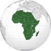
.svg)
