
Pierre, South Dakota
Pierre | ||
|---|---|---|
From left to right, from top: Downtown, Federal Building, St. Charles Hotel, Pierre Street Historic District, and the South Dakota State Capitol. | ||
|
FIPS code 46-49600 | | |
| GNIS feature ID | 1267533[3] | |
| Website | cityofpierre.org | |
.jpg)


Pierre (
Founded in 1880 on the Missouri River, the city was selected to be the state capital when South Dakota was created in 1889. Prior to achieving statehood, both Dakotas were part of Dakota Territory, with the territorial capital at Bismarck in what would become North Dakota.
History
.jpg)
Pierre was founded in 1880 on the east bank of the Missouri River opposite Fort Pierre, a former trading post that developed as a community. It was designated as the state capital when South Dakota gained statehood on November 2, 1889.
origin.Pierre's development was also influenced by construction of the Rapid City, Pierre and Eastern Railroad, which runs east–west through the city. It increased access to markets for regional products and improved transportation for passengers. The railroad crosses the Missouri River on the Chicago and North Western Railroad Bridge.
The capital city became relatively isolated in the post-World War II era of federally subsidized highway construction, as travelers and freight companies began to use automobiles and trucking. It is one of four state capitals not served by the Interstate Highway System.[6]
Geography

According to the United States Census Bureau, the city has an area of 13.07 square miles (33.85 km2), of which 13.06 square miles (33.83 km2) is land and 0.01 square miles (0.03 km2) is water.[7]
Pierre is sited on rough river bluffs above the east bank of the Missouri River, overlooking its expanse. It is a few miles away from Lake Oahe, one of the world's largest man-made lakes. Developed for flood control and irrigation, the lake has become a popular fishing destination.
Climate
Pierre has a relatively dry, four-season,
_-_PIERRE_REGIONAL_AP,SD.svg)
On July 23, 1973, an F3 tornado struck Pierre and caused 10 injuries.[14] It was the strongest tornado ever recorded in Hughes County.[15]
The beginnings of May and October see the last and first freezing nights, respectively, of the cooler season.[16] Precipitation is much lighter in the winter than in late spring and summer, and totals about 20 inches (508 mm) annually.[13] Extremes have ranged from −35 °F (−37 °C) on February 9, 1994, to 117 °F (47 °C) on July 15, 2006.[16]
| Climate data for Pierre, South Dakota (Pierre Regional Airport), 1991−2010 normals, extremes 1933–present | |||||||||||||
|---|---|---|---|---|---|---|---|---|---|---|---|---|---|
| Month | Jan | Feb | Mar | Apr | May | Jun | Jul | Aug | Sep | Oct | Nov | Dec | Year |
| Record high °F (°C) | 68 (20) |
75 (24) |
88 (31) |
98 (37) |
105 (41) |
112 (44) |
117 (47) |
114 (46) |
108 (42) |
98 (37) |
87 (31) |
77 (25) |
117 (47) |
| Mean maximum °F (°C) | 52.5 (11.4) |
58.2 (14.6) |
74.0 (23.3) |
84.3 (29.1) |
89.8 (32.1) |
96.6 (35.9) |
103.0 (39.4) |
101.9 (38.8) |
97.5 (36.4) |
86.1 (30.1) |
69.1 (20.6) |
54.5 (12.5) |
105.0 (40.6) |
| Mean daily maximum °F (°C) | 29.0 (−1.7) |
33.7 (0.9) |
45.7 (7.6) |
58.5 (14.7) |
69.5 (20.8) |
80.0 (26.7) |
88.3 (31.3) |
86.6 (30.3) |
77.5 (25.3) |
60.7 (15.9) |
44.9 (7.2) |
32.4 (0.2) |
58.9 (14.9) |
| Daily mean °F (°C) | 19.1 (−7.2) |
23.2 (−4.9) |
34.3 (1.3) |
45.9 (7.7) |
57.2 (14.0) |
67.8 (19.9) |
74.9 (23.8) |
73.0 (22.8) |
63.6 (17.6) |
48.5 (9.2) |
34.1 (1.2) |
22.8 (−5.1) |
47.0 (8.3) |
| Mean daily minimum °F (°C) | 9.3 (−12.6) |
12.6 (−10.8) |
22.9 (−5.1) |
33.3 (0.7) |
44.9 (7.2) |
55.6 (13.1) |
61.6 (16.4) |
59.4 (15.2) |
49.7 (9.8) |
36.2 (2.3) |
23.2 (−4.9) |
13.2 (−10.4) |
35.2 (1.8) |
| Mean minimum °F (°C) | −13.6 (−25.3) |
−8.8 (−22.7) |
−0.2 (−17.9) |
17.2 (−8.2) |
30.2 (−1.0) |
43.9 (6.6) |
50.5 (10.3) |
47.4 (8.6) |
33.4 (0.8) |
18.9 (−7.3) |
5.3 (−14.8) |
−8.0 (−22.2) |
−18.8 (−28.2) |
| Record low °F (°C) | −33 (−36) |
−35 (−37) |
−20 (−29) |
0 (−18) |
21 (−6) |
34 (1) |
42 (6) |
39 (4) |
21 (−6) |
2 (−17) |
−18 (−28) |
−31 (−35) |
−35 (−37) |
| Average precipitation inches (mm) | 0.45 (11) |
0.74 (19) |
0.96 (24) |
1.93 (49) |
3.25 (83) |
3.69 (94) |
2.39 (61) |
1.95 (50) |
1.74 (44) |
1.69 (43) |
0.77 (20) |
0.64 (16) |
20.20 (513) |
| Average snowfall inches (cm) | 5.1 (13) |
8.0 (20) |
5.0 (13) |
5.3 (13) |
0.0 (0.0) |
0.0 (0.0) |
0.0 (0.0) |
0.0 (0.0) |
0.0 (0.0) |
1.3 (3.3) |
6.3 (16) |
6.2 (16) |
37.2 (94) |
| Average precipitation days (≥ 0.01 in) | 5.9 | 5.8 | 5.6 | 8.7 | 11.0 | 11.4 | 9.1 | 7.9 | 6.4 | 6.8 | 5.3 | 5.6 | 89.5 |
| Average snowy days (≥ 0.1 in) | 5.6 | 5.3 | 3.3 | 2.0 | 0.0 | 0.0 | 0.0 | 0.0 | 0.0 | 0.7 | 3.9 | 5.2 | 26.0 |
| Source: | |||||||||||||
Graphs are unavailable due to technical issues. There is more info on Phabricator and on MediaWiki.org. |
See or edit raw graph data.
Demographics
| Census | Pop. | Note | %± |
|---|---|---|---|
| 1890 | 3,235 | — | |
| 1900 | 2,306 | −28.7% | |
| 1910 | 3,656 | 58.5% | |
| 1920 | 3,209 | −12.2% | |
| 1930 | 3,659 | 14.0% | |
| 1940 | 4,322 | 18.1% | |
| 1950 | 5,715 | 32.2% | |
| 1960 | 10,088 | 76.5% | |
| 1970 | 9,699 | −3.9% | |
| 1980 | 11,973 | 23.4% | |
| 1990 | 12,906 | 7.8% | |
| 2000 | 13,876 | 7.5% | |
| 2010 | 13,646 | −1.7% | |
| 2020 | 14,091 | 3.3% | |
| U.S. Decennial Census[17] 2018 Estimate[18][4] | |||
2010 census
As of the
There were 5,778 households, of which 29.2% had children under the age of 18 living with them, 45.7% were married couples living together, 10.4% had a female householder with no husband present, 3.8% had a male householder with no wife present, and 40.1% were non-families. 35.0% of all households were made up of individuals, and 11% had someone living alone who was 65 years of age or older. The average household size was 2.23 and the average family size was 2.87.
The median age in the city was 39.3 years. 22.9% of residents were under the age of 18; 7.5% were between the ages of 18 and 24; 26.7% were from 25 to 44; 28.9% were from 45 to 64; and 13.9% were 65 years of age or older. The gender makeup of the city was 47.8% male and 52.2% female.
2000 census
As of the
There were 5,567 households, out of which 32.9% had children under the age of 18 living with them, 51.6% were married couples living together, 9.5% had a female householder with no husband present, and 35.8% were non-families. 31.5% of all households were made up of individuals, and 10.7% had someone living alone who was 65 years of age or older. The average household size was 2.35, and the average family size was 2.96.
In the city, the population was spread out, with 27.2% under the age of 18, 6.5% from 18 to 24, 28.6% from 25 to 44, 23.6% from 45 to 64, and 14.1% who were 65 years of age or older. The median age was 38 years. For every 100 females, there were 90.5 males. For every 100 females age 18 and over, there were 85.4 males.
As of 2000 the median income for a household in the city was $42,962, and the median income for a family was $52,144. Males had a median income of $32,969 versus $22,865 for females. The
Education
The Pierre School District, the school district covering the city,[20] oversees three elementary schools, a middle school and a high school, T. F. Riggs High School. St. Joseph, is a private Catholic elementary school. It is administered by the local parish and the Diocese of Sioux Falls. Other schools include For His Glory and the Pierre Indian Learning Center (a tribal school affiliated with the Bureau of Indian Education).
Media
Television
| Television | |
|---|---|
| Channel ( Digital )
|
Callsign
|
| 7.1 | K14IO-D |
| 11.1 | KPLO-LD |
| 11.2 | KPLO-LD |
| 13.1 | KPRY |
| 13.2 | KPRY |
| 13.3 | KPRY |
| 34.1 | K34GM-D |
| 46.1 | K27HJ-D
|
| 46.2 | K27HJ-D
|
AM radio
AM radio stations
| |||||
|---|---|---|---|---|---|
| Frequency | Call sign | ||||
| 1060 AM | KGFX | ||||
| 1240 AM | KCCR | ||||
FM radio
FM radio stations
| |
|---|---|
| Frequency | Call sign |
| 89.1 FM | KVFL |
| 89.5 FM | K208FM |
| 90.3 FM | KSLP |
| 91.7 FM | KTSD |
| 92.7 FM | KGFX-FM |
| 94.5 FM | KPLO-FM |
| 95.3 FM | KLXS
|
| 96.3 FM | K242CH |
| 98.9 FM | K255DE |
| 100.1 FM | KJBI |
| 100.5 FM | K263AW |
| 104.5 FM | KCCR-FM |
| 105.1 FM | KPGN-LP
|
| 107.1 FM | K296FI |
Newspaper
The Capital Journal is the local newspaper and has been in circulation since 1881. OaheTV is the local public/education/government cable channel serving Pierre, Fort Pierre on Midcontinent Communications Cable.
Infrastructure
Transportation
Public transit is provided by River Cities Public Transit.
Pierre Regional Airport is served by one commercial airline.
Although in the center of the state, Pierre is one of only four state capitals not served by an Interstate highway (along with Dover, Delaware, Jefferson City, Missouri, and Juneau, Alaska). It is the only one that is not served by any expressways.[21] The nearest Interstate highway is Interstate 90, about 34 mi (55 km) south of Pierre via the four-lane U.S. Highway 83.[22]
The Rapid City, Pierre and Eastern Railroad runs east–west through the city. The railroad crosses the Missouri River on the Chicago and North Western Railroad Bridge.
Notable people
- Angela Aames, actress
- Floyd Bannister, Major League Baseball player
- Joseph Bottum, writer
- Robert Gleckler, actor
- Dusty Johnson, U.S. representative from South Dakota (born in Pierre in 1976)
- Byron S. Payne, Attorney General of South Dakota[23]
- Rex Robbins, actor
- Mike Rounds, U.S. senator from South Dakota and former governor of South Dakota (resident of Fort Pierre).
- John Thune, U.S. senator from South Dakota (born in Pierre in 1961)
In popular culture
In 2015, in honor of the 80th anniversary of the "Monopoly" board game, Hasbro held an online vote to determine which cities should be included in an updated version of the "Here and Now: The US Edition" of the game. The top "Boardwalk" spot went to an unexpected contender: Pierre. It received the most votes, beating New York, Los Angeles, Chicago, and Boston.[24][25] The outcome may have been influenced by the image that accompanied the name of the city in the balloting: the well-known Mount Rushmore, which is 150 miles west of Pierre, in Keystone and the Black Hills section of the state.[26]
References
- ^ William D. Halsey, ed. (1976). "Pierre". Collier's Encyclopedia. Vol. 19. New York: Macmillan Educational Corporation. pp. 42–43.
- ^ "ArcGIS REST Services Directory". United States Census Bureau. Retrieved October 15, 2022.
- ^ a b U.S. Geological Survey Geographic Names Information System: Pierre, South Dakota
- ^ a b "Census Population API". United States Census Bureau. Retrieved October 15, 2022.
- ^ "Find a County". National Association of Counties. Archived from the original on May 31, 2011. Retrieved June 7, 2011.
- ^ "Part VII - Miscellaneous Interstate Facts - Engineering Data - Interstate System - Highway History - Federal Highway Administration". www.fhwa.dot.gov. Retrieved March 5, 2022.
- ^ "US Gazetteer files 2010". United States Census Bureau. Archived from the original on January 25, 2012. Retrieved June 21, 2012.
- ^ Peel, M.C., Finlayson, B.L., and McMahon, T.A.: Updated American map of the Köppen-Geiger climate classification. Earth Syst. Sci., 11, 1633–1644, 2007.
- ^ "What is my arborday.org Hardiness Zone?". Archived from the original on June 30, 2013. Retrieved April 9, 2016.
- ^ Data, US Climate. "Climate Pierre - South Dakota and Weather averages Pierre - Weather history january 2018". www.usclimatedata.com. Archived from the original on October 17, 2018. Retrieved October 16, 2018.
- ^ "Interactive United States Koppen-Geiger Climate Classification Map". www.plantmaps.com. Archived from the original on October 11, 2018. Retrieved October 16, 2018.
- ^ "Updated Köppen-Geiger climate map of the world". people.eng.unimelb.edu.au. Retrieved October 16, 2018.
- ^ a b c d e f "Station: Pierre RGNL AP, SD". U.S. Climate Normals 2020: U.S. Monthly Climate Normals (1991-2020). National Oceanic and Atmospheric Administration. Archived from the original on July 3, 2023. Retrieved October 13, 2021.
- ^ "Tornado History Project: 19730723.46.22". Archived from the original on April 4, 2018. Retrieved April 3, 2018.
- ^ "Tornado History Project: Hughes County, South Dakota". Archived from the original on April 4, 2018. Retrieved April 3, 2018.
- ^ a b c "NowData - NOAA Online Weather Data". National Oceanic and Atmospheric Administration. Retrieved October 13, 2021.
- ^ United States Census Bureau. "Census of Population and Housing". Retrieved September 23, 2013.
- ^ "Population Estimates". United States Census Bureau. Retrieved February 28, 2020.[dead link]
- ^ "U.S. Census website". United States Census Bureau. Retrieved June 21, 2012.
- U.S. Census Bureau. Retrieved March 13, 2024. - Text list
- ^ "The Dwight D. Eisenhower System of Interstate and Defense Highways - Part VII - Miscellaneous Interstate Facts". Federal Highway Administration. Archived from the original on July 16, 2018. Retrieved June 3, 2018.
- ^ John E. Miller, Looking for History on Highway 14 (Pierre: South Dakota State Historical Society Press, 2001)
- Newspapers.com.
- ^ Burbach, Kevin (March 19, 2015). "Pierre Gets Top Spot on New Monopoly Game". Argus Leader. Retrieved March 20, 2015.
- ^ "Monopoly". BuzzFeed. Archived from the original on 20 March 2016. Retrieved 9 April 2016.[unreliable source?]
- ^ "Distance between Pierre, SD and Keystone, SD". www.distance-cities.com. Archived from the original on June 11, 2016. Retrieved June 9, 2016.
External links
- Pierre Chamber of Commerce
- Pierre city government official website
 Pierre travel guide from Wikivoyage
Municipalities and communities of Hughes County, South Dakota, United States | ||
|---|---|---|
| Cities | 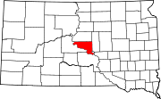 | |
| Town | ||
| Township | ||
| Indian reservation | ||
| CDP | ||
| Other communities | ||
| Footnotes | ‡This populated place also has portions in an adjacent county or counties | |
| ||
| International | |
|---|---|
| National | |
| Geographic | |
| Other | |