
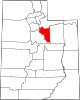
Wasatch County, Utah
Wasatch County | |
|---|---|
Heber City . | |
|
UTC−6 (MDT) | |
| Congressional district | 3rd |
| Website | www |
Wasatch County (
Wasatch County is part of the Heber, UT
History
The first settlers were Mormon pioneers, in 1859, settling near present Heber City, Midway, and Charleston. On January 17, 1862, the Utah Territory legislature created the county, annexing areas from Great Salt Lake, Green River, Sanpete, Summit, and Utah counties. Heber was selected as the county seat. Wasatch in Ute means "mountain pass" or "low pass over high range". Heber City was named for
Geography
Heber Valley has a relatively cool climate since it is mountain-ringed, and over half the land is 7,500 feet (2,300 metres) above sea level. The average annual precipitation is about 16 inches (410 millimetres). The county is divided into two watersheds—the Colorado and the Great Basin drainage systems.[4] Flowing from the East are Daniels, Lake Fork, and Center creeks. From the north and northeast is the Provo River. Flowing from the west is Snake Creek. The county's highest point is the west slope of Murdock Mountain[4] in the Uinta Mountains, at 10,840 ft (3,300 m) ASL.[5]
Wasatch County has a total area of 1,206 square miles (3,120 km2), of which 1,176 square miles (3,050 km2) is land and 30 square miles (78 km2) (2.5%) is water.[6]
Major highways
Adjacent counties
- Salt Lake County - northwest
- Summit County - north
- Duchesne County - east
- Utah County - southwest
Protected areas
- Ashley National Forest (part)
- Currant Creek Campground (USFS)
- Currant Creek Wildlife Management Area (part)
- Deer Creek State Park
- Rock Cliff Campground (Utah State Park)
- Soldier Creek Recreational Area
- Uinta National Forest (part)
- Wasatch Mountain State Park
- Wasatch National Forest (part)
- Wildcat Mountain Wildlife Management Area[4]
Lakes
- Currant Creek Reservoir
- Deer Creek Reservoir
- Jordanelle Reservoir
- Strawberry Reservoir
- Witts Lake[4]
Demographics
| Census | Pop. | Note | %± |
|---|---|---|---|
| 1870 | 1,244 | — | |
| 1880 | 2,927 | 135.3% | |
| 1890 | 3,595 | 22.8% | |
| 1900 | 4,786 | 33.1% | |
| 1910 | 8,920 | 86.4% | |
| 1920 | 4,625 | −48.2% | |
| 1930 | 5,636 | 21.9% | |
| 1940 | 5,754 | 2.1% | |
| 1950 | 5,574 | −3.1% | |
| 1960 | 5,308 | −4.8% | |
| 1970 | 5,863 | 10.5% | |
| 1980 | 8,523 | 45.4% | |
| 1990 | 10,089 | 18.4% | |
| 2000 | 15,215 | 50.8% | |
| 2010 | 23,530 | 54.7% | |
| 2020 | 34,788 | 47.8% | |
| US Decennial Census[7] 1790–1960[8] 1900–1990[9] 1990–2000[10] 2010[11] 2020[12] | |||
2010 census
As of the
There were 7,287 households, out of which 43.1% had children under the age of 18 living with them, 68.70% were married couples living together, 7.4% had a female householder with no husband present, 3.8% had a male householder with no wife present, and 20.1% were non-families. 15.5% of all households were made up of individuals, and 4.8% had someone living alone who was 65 years of age or older. The average household size was 3.18 and the average family size was 3.19.
The county population contained 36.3% under the age of 20, 5.2% from 20 to 24, 28.1% from 25 to 44, 21.9% from 45 to 64, and 8.6% who were 65 years of age or older. The median age was 31.6 years. For every 100 females there were 103.40 males. For every 100 females age 18 and over, there were 101.5 males.
2000 census
As of the
Communities
Cities
- Heber City (county seat)
- Midway
- Park City (part)[13]
Towns
Census-designated places
Unincorporated communities
- Center Creek
- Deer Mountain
- Mayflower Mountain
- Soldier Creek Estates
- Soldier Summit
- Wildwood (part)
Former communities
Politics and government
The county is governed by a seven-member county council with an appointed county manager.[14]
Wasatch County has traditionally voted Republican. In no national election since 1964 has the county selected the Democratic Party candidate (as of 2020).
| Position | District | Name | Affiliation | First elected | |
|---|---|---|---|---|---|
Senate
|
16 | Curt Bramble | Republican | 2000[15] | |
Senate
|
26 | Ronald Winterton | Republican | 2018[16] | |
Senate
|
27 | David Hinkins | Republican | 2008[17] | |
| House of Representatives | 54 | Mike Kohler | Republican | 2020[18] | |
| Board of Education | 12 | James Moss Jr. | Republican | 2020[19] | |
| Year | Republican | Democratic | Third party | |||
|---|---|---|---|---|---|---|
| No. | % | No. | % | No. | % | |
| 2020 | 10,795 | 60.68% | 6,187 | 34.78% | 808 | 4.54% |
| 2016 | 6,115 | 49.85% | 3,063 | 24.97% | 3,088 | 25.18% |
| 2012 | 7,220 | 74.90% | 2,191 | 22.73% | 229 | 2.38% |
| 2008 | 5,430 | 62.96% | 2,892 | 33.53% | 303 | 3.51% |
| 2004 | 5,503 | 73.26% | 1,854 | 24.68% | 155 | 2.06% |
| 2000 | 3,819 | 67.30% | 1,476 | 26.01% | 380 | 6.70% |
| 1996 | 2,222 | 52.38% | 1,374 | 32.39% | 646 | 15.23% |
| 1992 | 1,822 | 42.02% | 1,042 | 24.03% | 1,472 | 33.95% |
| 1988 | 2,487 | 62.22% | 1,451 | 36.30% | 59 | 1.48% |
| 1984 | 2,789 | 72.93% | 1,015 | 26.54% | 20 | 0.52% |
| 1980 | 2,799 | 70.93% | 994 | 25.19% | 153 | 3.88% |
| 1976 | 1,940 | 61.59% | 1,092 | 34.67% | 118 | 3.75% |
| 1972 | 2,046 | 70.21% | 693 | 23.78% | 175 | 6.01% |
| 1968 | 1,611 | 60.95% | 941 | 35.60% | 91 | 3.44% |
| 1964 | 1,158 | 44.92% | 1,420 | 55.08% | 0 | 0.00% |
| 1960 | 1,480 | 58.11% | 1,066 | 41.85% | 1 | 0.04% |
| 1956 | 1,738 | 66.79% | 864 | 33.21% | 0 | 0.00% |
| 1952 | 1,677 | 63.40% | 968 | 36.60% | 0 | 0.00% |
| 1948 | 1,165 | 48.77% | 1,219 | 51.03% | 5 | 0.21% |
| 1944 | 1,058 | 45.82% | 1,249 | 54.09% | 2 | 0.09% |
| 1940 | 1,199 | 44.37% | 1,502 | 55.59% | 1 | 0.04% |
| 1936 | 1,029 | 44.09% | 1,299 | 55.66% | 6 | 0.26% |
| 1932 | 1,042 | 48.17% | 1,103 | 50.99% | 18 | 0.83% |
| 1928 | 1,340 | 57.83% | 973 | 41.99% | 4 | 0.17% |
| 1924 | 1,105 | 52.39% | 727 | 34.47% | 277 | 13.13% |
| 1920 | 1,061 | 61.05% | 665 | 38.26% | 12 | 0.69% |
| 1916 | 817 | 47.61% | 885 | 51.57% | 14 | 0.82% |
| 1912 | 1,210 | 41.71% | 957 | 32.99% | 734 | 25.30% |
| 1908 | 1,265 | 53.83% | 985 | 41.91% | 100 | 4.26% |
| 1904 | 1,042 | 60.79% | 656 | 38.27% | 16 | 0.93% |
| 1900 | 723 | 47.91% | 781 | 51.76% | 5 | 0.33% |
| 1896 | 51 | 3.68% | 1,333 | 96.32% | 0 | 0.00% |
Education
All areas of the county are in the Wasatch County School District.[13]
See also
References
- ^ "Wasatch County, Utah". United States Census Bureau. Retrieved July 1, 2023.
- ^ "Find a County". National Association of Counties. Retrieved June 7, 2011.
- ^ "Individual County Chronologies/Wasatch County UT. [[Newberry Library]] (accessed April 1, 2019)". Archived from the original on March 6, 2016. Retrieved April 1, 2019.
- ^ a b c d e Wasatch County UT Google Maps (accessed 1 April 2019)
- ^ Utah County High Points/Wasatch County. Peakbagger (accessed 1 April 2019)
- ^ "2010 Census Gazetteer Files". US Census Bureau. August 22, 2012. Retrieved June 26, 2015.
- ^ "US Decennial Census". US Census Bureau. Retrieved June 26, 2015.
- ^ "Historical Census Browser". University of Virginia Library. Retrieved June 26, 2015.
- ^ Forstall, Richard L., ed. (March 27, 1995). "Population of Counties by Decennial Census: 1900 to 1990". US Census Bureau. Retrieved June 26, 2015.
- ^ "Census 2000 PHC-T-4. Ranking Tables for Counties: 1990 and 2000" (PDF). US Census Bureau. April 2, 2001. Retrieved June 26, 2015.
- ^ "State & County QuickFacts". United States Census Bureau. Archived from the original on September 2, 2011. Retrieved December 30, 2013.
- ^ 2020 Population and Housing State Data | Utah
- ^ U.S. Census Bureau. Retrieved November 2, 2022. - Text list
- ^ "Wasatch County Administrative Services". Archived from the original on September 30, 2011. Retrieved October 17, 2011.
- ^ "Senator Bramble Utah Senate". senate.utah.gov. Retrieved November 16, 2021.
- ^ "Senator Winterton Utah Senate". senate.utah.gov. Retrieved November 16, 2021.
- ^ "Senator Hinkins Utah Senate". senate.utah.gov. Retrieved November 16, 2021.
- ^ "Rep. Kohler, Mike L." Utah House of Representatives. Retrieved November 17, 2021.
- ^ "James Moss Jr". www.schools.utah.gov. Retrieved November 16, 2021.
- ^ Leip, David. "Atlas of US Presidential Elections". uselectionatlas.org. Retrieved March 31, 2018.
External links
Places adjacent to Wasatch County, Utah | ||||||||||||||||
|---|---|---|---|---|---|---|---|---|---|---|---|---|---|---|---|---|
| ||||||||||||||||
 | ||||
Towns | ||||
| CDP | ||||
| Unincorporated community | ||||
| Indian reservation | ||||
| Ghost towns | ||||
| Footnotes | ‡This populated place also has portions in an adjacent county or counties | |||
| ||||
| International | |
|---|---|
| National | |